Pictures
| # |
ID


|
Uploaded by
|
Uploaded on

|
Picture
|
Description
|
Related item(s)
|


|
| 5626 |
6558 |
 bali |
2018-05-25 21:35:52 |
 |
By United States Geological Survey (USGS) - USGS The National Map, via MSR Maps (formerly TerraServer-USA)http://msrmaps.com, Public Domain, https://commons.wikimedia.org/w/index.php?curid=3530907 |
Airport Wichita Falls Municipal Airport (KSPS) |
|
| 5627 |
6557 |
bali |
2018-05-25 21:35:41 |
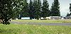 |
By Tedder - Own work, CC BY 3.0, https://commons.wikimedia.org/w/index.php?curid=7082488 |
Airport Scappoose Industrial Airpark (KSPB) |
|
| 5628 |
6556 |
bali |
2018-05-25 21:35:33 |
 |
By PegasusRacer28 - Own work, CC BY-SA 3.0, https://commons.wikimedia.org/w/index.php?curid=19848791 |
Airport Spartanburg Downtown Memorial Airport (KSPA) |
|
| 5629 |
6555 |
bali |
2018-05-25 21:35:24 |
 |
By United States Geological Survey (USGS) - USGS via TopoQuesthttp://www.topoquest.com/map.php?lat=36.66278&lon=-121.60639&datum=nad83&zoom=4&map=sat1m&coord=d&mode=zoomin&size=l, Public Domain, https://commons.wikimedia.org/w/index.php?curid=172164 |
Airport Salinas Municipal Airport (KSNS) |
|
| 5630 |
6554 |
bali |
2018-05-25 21:35:11 |
 |
By United States Geological Survey (USGS) - USGS via TopoQuesthttp://www.topoquest.com/map.php?lat=34.89889&lon=-120.45750&datum=nad83&zoom=4&map=sat1m&coord=d&mode=zoomin&size=l, Public Domain, https://commons.wikimedia.org/w/index.php?curid=172933 |
Airport Santa Maria Public Airport (KSMX) |
|
| 5631 |
6553 |
bali |
2018-05-25 21:34:58 |
 |
By Akersmc - Taken while piloting my own aircraft to Somerset Airport, CC BY-SA 3.0, https://commons.wikimedia.org/w/index.php?curid=19631565 |
Airport Somerset Airport (New Jersey) (KSMQ) |
|
| 5632 |
6552 |
bali |
2018-05-25 21:34:49 |
 |
By Amadscientist - Own work, CC BY-SA 4.0, https://commons.wikimedia.org/w/index.php?curid=35682896 |
Airport Sacramento International Airport (KSMF) |
|
| 5633 |
6551 |
bali |
2018-05-25 21:34:40 |
 |
By United States Geological Survey (USGS) - USGS digital orthophoto via MSR Maps (formerly TerraServer-USA), Public Domain, https://commons.wikimedia.org/w/index.php?curid=10387857 |
Airport Smith Field (Indiana) (KSMD) |
|
| 5634 |
6550 |
bali |
2018-05-25 21:34:29 |
 |
By United States Geological Survey (USGS) - USGS The National Map, via MSR Maps (formerly TerraServer-USA)Interactive map: http://msrmaps.com/map.aspx?t=1&s=12&lat=38.7949&lon=-97.6522&w=1000&h=1300Image: http://msrmaps.com/GetImageArea.ashx?t=1&s=1 |
Airport Salina Regional Airport (KSLN) |
|
| 5635 |
6549 |
bali |
2018-05-25 21:34:16 |
 |
By Don Ramey Logan - Own work, CC BY 4.0, https://commons.wikimedia.org/w/index.php?curid=39458412 |
Airport Los Alamitos Army Airfield (KSLI) |
|
| 5636 |
6548 |
bali |
2018-05-25 21:34:07 |
 |
By United States Geological Survey (USGS) - USGS via TopoQuesthttp://www.topoquest.com/map.php?lat=44.909444&lon=-123.0025&datum=nad83&zoom=4&map=sat1m, Public Domain, https://commons.wikimedia.org/w/index.php?curid=19565846 |
Airport McNary Field (KSLE) |
|
| 5637 |
6547 |
bali |
2018-05-25 21:33:55 |
 |
By US gov - US gov, Public Domain, https://commons.wikimedia.org/w/index.php?curid=3710366 |
Airport Lackland Air Force Base (KSKF) |
|
| 5638 |
6546 |
bali |
2018-05-25 21:33:46 |
 |
By USAF - http://public.fairchild.amc.af.mil/shared/media/photodb/photos/021202-O-9999G-100.jpg, Public Domain, https://commons.wikimedia.org/w/index.php?curid=5058580 |
Airport Fairchild AFB (KSKA) |
|
| 5639 |
6545 |
bali |
2018-05-25 21:33:36 |
 |
By United States Geological Survey (USGS) - USGS via TopoQuesthttp://www.topoquest.com/map.php?lat=31.35858&lon=-100.49922&datum=nad83&zoom=4&map=sat1m&coord=d&mode=pan&size=l, Public Domain, https://commons.wikimedia.org/w/index.php?curid=19544702 |
Airport San Angelo Regional Airport (KSJT) |
|
| 5640 |
6544 |
bali |
2018-05-25 21:33:23 |
 |
By United States Geological Survey (USGS) - USGS via TopoQuesthttp://www.topoquest.com/map.php?lat=41.77993&lon=-122.46836&datum=nad83&zoom=4&map=sat1m&coord=d&mode=pan&size=l, Public Domain, https://commons.wikimedia.org/w/index.php?curid=19872477 |
Airport Siskiyou County Airport (KSIY) |
|
| 5641 |
6543 |
bali |
2018-05-25 21:33:10 |
 |
By United States Geological Survey (USGS) - USGS via TopoQuesthttp://www.topoquest.com/map.php?lat=36.89889&lon=-89.56167&datum=nad83&zoom=4&map=sat1m&coord=d&mode=zoomin&size=l, Public Domain, https://commons.wikimedia.org/w/index.php?curid=1966494 |
Airport Sikeston Memorial Municipal Airport (KSIK) |
|
| 5642 |
6542 |
bali |
2018-05-25 21:32:57 |
 |
By Indy beetle - Own work, CC BY-SA 4.0, https://commons.wikimedia.org/w/index.php?curid=57909298 |
Airport Rockingham County NC Shiloh Airport (KSIF) |
|
| 5643 |
6541 |
bali |
2018-05-25 21:32:49 |
 |
By United States Geological Survey (USGS) - USGS via GPS Visualizer websitehttp://www.gpsvisualizer.com/map_input?special=wikipedia&format=google&bg_map=usgs_aerial&sp_width=50km&form:data=type,name,latitude,longitude%0DW,%22Stuttgart%20Municipal%20 |
Airport Stuttgart Municipal Airport (KSGT) |
|
| 5644 |
6540 |
bali |
2018-05-25 21:32:36 |
 |
By Nenyedi at English Wikipedia - Own work (Original text: I created this work entirely by myself.), Attribution, https://commons.wikimedia.org/w/index.php?curid=11665404 |
Airport South St. Paul Municipal Airport (KSGS) |
|
| 5645 |
6539 |
bali |
2018-05-25 21:32:26 |
 |
By User:Nyttend - Own work, Public Domain, https://commons.wikimedia.org/w/index.php?curid=4512726 |
Airport Springfield-Beckley Municipal Airport (KSGH) |
|
| 5646 |
6538 |
bali |
2018-05-25 21:32:17 |
 |
By Gleby - Own work, CC BY-SA 3.0, https://commons.wikimedia.org/w/index.php?curid=15838554 |
Airport Felts Field (KSFF) |
|
| 5647 |
6537 |
bali |
2018-05-25 21:32:09 |
 |
By United States Geological Survey (USGS) - USGS The National Map, via MSR Maps (formerly TerraServer-USA)http://msrmaps.com/map.aspx?t=1&s=12&lon=-85.908333&lat=38.924722&w=800&h=800, Public Domain, https://commons.wikimedia.org/w/index.php?curid=9 |
Airport Freeman Municipal Airport (KSER) |
|
| 5648 |
6536 |
bali |
2018-05-25 21:31:56 |
 |
By United States Department of Agriculture (USDA), Farm Services Agency - National Agriculture Imagery Program (NAIP) Orthoimagery for Zone 16 Alabama State Quarter Quadrangle BLACKWELL BEND, NE and I.D. # n_3208748_ne_16_1_20060630.tif, Public Doma |
Airport Craig Field (airport) (KSEM) |
|
| 5649 |
6535 |
bali |
2018-05-25 21:31:42 |
 |
By Jakec at English Wikipedia, CC BY-SA 4.0, https://commons.wikimedia.org/w/index.php?curid=61616573 |
Airport Penn Valley Airport (KSEG) |
|
| 5650 |
6534 |
bali |
2018-05-25 21:31:34 |
 |
By United States Geological Survey (USGS) - USGS via GPS Visualizer websitehttp://www.gpsvisualizer.com/map_input?special=wikipedia&format=google&bg_map=usgs_aerial&sp_width=50km&form:data=type,name,latitude,longitude%0DW,%22Sebring%20Regional%20Air |
Airport Sebring Regional Airport (KSEF) |
|
|
|
|
|
|
|
|
|
| # |
ID
|
Uploaded by
|
Uploaded on
|
Picture
|
Description
|
Related item(s)
|
|


