Pictures
| # |
ID


|
Uploaded by
|
Uploaded on

|
Picture
|
Description
|
Related item(s)
|


|
| 5676 |
6508 |
 bali |
2018-05-25 21:26:56 |
 |
By United States Geological Survey (USGS) - USGS The National Map, via MSR Maps (formerly TerraServer-USA)http://msrmaps.com/map.aspx?t=1&s=13&lon=-75.409641&lat=43.230821&w=800&h=800, Public Domain, https://commons.wikimedia.org/w/index.php?curid=4 |
Airport Griffiss International Airport (KRME) |
|
| 5677 |
6507 |
bali |
2018-05-25 21:26:43 |
 |
By Aviationism - Own work, CC BY-SA 4.0, https://commons.wikimedia.org/w/index.php?curid=65340314 |
Airport Rock Springs-Sweetwater County Airport (KRKS) |
|
| 5678 |
6506 |
bali |
2018-05-25 21:26:35 |
 |
By Jp498 at English Wikipedia - Transferred from en.wikipedia to Commons by Premeditated Chaos using CommonsHelper., Public Domain, https://commons.wikimedia.org/w/index.php?curid=18007641 |
Airport Knox County Regional Airport (KRKD) |
|
| 5679 |
6505 |
bali |
2018-05-25 21:26:24 |
 |
By Don Ramey Logan - Own work, CC BY 4.0, https://commons.wikimedia.org/w/index.php?curid=39529558 |
Airport March Air Reserve Base (KRIV) |
|
| 5680 |
6504 |
bali |
2018-05-25 21:26:15 |
 |
By Wingtipvortex - Own work, CC BY-SA 3.0, https://en.wikipedia.org/w/index.php?curid=36802933 |
Airport Flabob Airport (KRIR) |
|
| 5681 |
6503 |
bali |
2018-05-25 21:26:07 |
 |
By Jake Mackenzie (Transfinite) - Own work, CC BY-SA 3.0, https://commons.wikimedia.org/w/index.php?curid=1768684 |
Airport Chicago Rockford International Airport (KRFD) |
|
| 5682 |
6502 |
bali |
2018-05-25 21:25:58 |
 |
By Wingtipvortex - Own work, CC BY-SA 3.0, https://en.wikipedia.org/w/index.php?curid=36802933 |
Airport Redlands Municipal Airport (KREI) |
|
| 5683 |
6501 |
bali |
2018-05-25 21:25:50 |
 |
By Johnny Saldivar - https://www.flickr.com/photos/usairforce/6164052926/in/photostream/, Public Domain, https://commons.wikimedia.org/w/index.php?curid=16674921 |
Airport Grand Forks AFB (KRDR) |
|
| 5684 |
6500 |
bali |
2018-05-25 21:25:40 |
 |
By United States Geological Survey (USGS) - USGS via TopoQuesthttp://www.topoquest.com/map.php?lat=40.50889&lon=-122.29333&datum=nad83&zoom=4&map=sat1m&coord=d&mode=zoomin&size=l, Public Domain, https://commons.wikimedia.org/w/index.php?curid=172162 |
Airport Redding Municipal Airport (KRDD) |
|
| 5685 |
6499 |
bali |
2018-05-25 21:25:27 |
 |
By Jonmkj - Own work, Public Domain, https://commons.wikimedia.org/w/index.php?curid=11725011 |
Airport Richmond County Airport (KRCZ) |
|
| 5686 |
6498 |
bali |
2018-05-25 21:25:19 |
 |
Public Domain, https://en.wikipedia.org/w/index.php?curid=6834427 |
Airport Nartron Field (KRCT) |
|
| 5687 |
6497 |
bali |
2018-05-25 21:25:11 |
 |
By United States Geological Survey (USGS) - USGS via TopoQuesthttp://www.topoquest.com/map.php?lat=35.488056&lon=-97.823611&datum=nad83&zoom=4&map=sat1m, Public Domain, https://commons.wikimedia.org/w/index.php?curid=19573186 |
Airport Clarence E. Page Municipal Airport (KRCE) |
|
| 5688 |
6496 |
bali |
2018-05-25 21:24:59 |
 |
By Unietd States Air Force - Ellsworth AFB website http://www.ellsworth.af.mil/photos/mediagallery.asp?galleryID=1001&page=4, Public Domain, https://commons.wikimedia.org/w/index.php?curid=8866962 |
Airport Ellsworth AFB (KRCA) |
|
| 5689 |
6495 |
bali |
2018-05-25 21:24:48 |
 |
By United States Geological Survey (USGS) - USGS via TopoQuesthttp://www.topoquest.com/map.php?lat=32.92100&lon=-80.64061&datum=nad83&zoom=4&map=sat1m&coord=d&mode=zoomin&size=l, Public Domain, https://commons.wikimedia.org/w/index.php?curid=1951757 |
Airport Lowcountry Regional Airport (KRBW) |
|
| 5690 |
6494 |
bali |
2018-05-25 21:24:35 |
 |
By United States Geological Survey (USGS) - USGS The National Map, via MSR Maps (formerly TerraServer-USA)http://msrmaps.com/map.aspx?t=1&s=10&lat=34.8457&lon=-92.3031&w=2000&h=2000, Public Domain, https://commons.wikimedia.org/w/index.php?curid=170 |
Airport Robinson Army Airfield (KRBM) |
|
| 5691 |
6493 |
bali |
2018-05-25 21:24:21 |
 |
By Eric Salard - RBD DALLAS EXECUTIVE AIRPORT FROM FLIGHT CDG-IAH 777 F-GSQM, CC BY-SA 2.0, https://commons.wikimedia.org/w/index.php?curid=29388773 |
Airport Dallas Executive Airport (KRBD) |
|
| 5692 |
6492 |
bali |
2018-05-25 21:24:11 |
 |
By Wingtipvortex - Own work, CC BY-SA 3.0, https://en.wikipedia.org/w/index.php?curid=36802933 |
Airport Riverside Municipal Airport (KRAL) |
|
| 5693 |
6491 |
bali |
2018-05-25 21:24:02 |
 |
By United States Geological Survey (USGS) - USGS via TopoQuesthttp://www.topoquest.com/map.php?lat=32.510556&lon=-83.767222&datum=nad83&zoom=4&map=sat1m, Public Domain, https://commons.wikimedia.org/w/index.php?curid=20249745 |
Airport Perry-Houston County Airport (KPXE) |
|
| 5694 |
6490 |
bali |
2018-05-25 21:23:50 |
 |
By United States Geological Survey (USGS) - USGS The National Map, via MSR Maps (formerly TerraServer-USA)http://msrmaps.com/map.aspx?t=1&s=12&lon=-101.717222&lat=34.168056&w=800&h=800, Public Domain, https://commons.wikimedia.org/w/index.php?curid= |
Airport Hale County Airport (KPVW) |
|
| 5695 |
6489 |
bali |
2018-05-25 21:23:37 |
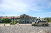 |
By tap houston - P-town Airport, CC BY 2.0, https://commons.wikimedia.org/w/index.php?curid=26278994 |
Airport Provincetown Municipal Airport (KPVC) |
|
| 5696 |
6488 |
bali |
2018-05-25 21:23:29 |
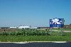 |
By Dual Freq - Own work, CC BY-SA 3.0, https://commons.wikimedia.org/w/index.php?curid=4161679 |
Airport Platteville Municipal Airport (KPVB) |
|
| 5697 |
6487 |
bali |
2018-05-25 21:23:21 |
 |
By Thomson200 - Own work, CC BY-SA 4.0, https://commons.wikimedia.org/w/index.php?curid=49185972 |
Airport Silver Comet Field at Paulding Northwest Atlanta Airport (KPUJ) |
|
| 5698 |
6486 |
bali |
2018-05-25 21:23:12 |
 |
By United States Geological Survey (USGS) - USGS via TopoQuesthttp://www.topoquest.com/map.php?lat=36.029722&lon=-119.062778&datum=nad83&zoom=4&map=sat1m, Public Domain, https://commons.wikimedia.org/w/index.php?curid=19869632 |
Airport Porterville Municipal Airport (KPTV) |
|
| 5699 |
6485 |
bali |
2018-05-25 21:23:00 |
 |
By United States Geological Survey (USGS) - USGS via GPS Visualizer websitehttp://www.gpsvisualizer.com/map_input?special=wikipedia&format=google&bg_map=usgs_aerial&sp_width=50km&form:data=type,name,latitude,longitude%0DW,%22Pratt%20Army%20Airfield% |
Airport Pratt Regional Airport (KPTT) |
|
| 5700 |
6484 |
bali |
2018-05-25 21:22:47 |
 |
By United States Geological Survey (USGS) - USGS The National Map, via MSR Maps (formerly TerraServer-USA)http://msrmaps.com/map.aspx?t=1&s=12&lon=-94.7310855842911&lat=37.4422417310765&w=600&h=400&opt=0&f=Tahoma,Verdana,Arial&fs=8&fc=ffffff99, Publ |
Airport Atkinson Municipal Airport (KPTS) |
|
|
|
|
|
|
|
|
|
| # |
ID
|
Uploaded by
|
Uploaded on
|
Picture
|
Description
|
Related item(s)
|
|