Pictures
| # |
ID


|
Uploaded by
|
Uploaded on

|
Picture
|
Description
|
Related item(s)
|


|
| 5726 |
6458 |
 bali |
2018-05-25 21:18:04 |
 |
By self - Own work, CC BY-SA 2.5, https://commons.wikimedia.org/w/index.php?curid=2531979 |
Airport Waupaca Municipal Airport (KPCZ) |
|
| 5727 |
6457 |
bali |
2018-05-25 21:17:56 |
 |
By I, the copyright holder of this work, hereby publish it under the following license: - Own work, CC BY-SA 3.0, https://commons.wikimedia.org/w/index.php?curid=25098858 |
Airport Price County Airport (KPBH) |
|
| 5728 |
6456 |
bali |
2018-05-25 21:17:46 |
 |
By United States Geological Survey (USGS) - USGS The National Map, via MSR Maps (formerly TerraServer-USA)http://msrmaps.com/map.aspx?t=1&s=12&lon=-91.935597&lat=34.173142&w=600&h=800, Public Domain, https://commons.wikimedia.org/w/index.php?curid=9 |
Airport Grider Field (KPBF) |
|
| 5729 |
6455 |
bali |
2018-05-25 21:17:33 |
 |
By USAF photo by Tech. Sgt. Mike Ammons - http://www.f-16.net/gallery_item88540.html, Public Domain, https://commons.wikimedia.org/w/index.php?curid=3914817 |
Airport Tyndall Air Force Base (KPAM) |
|
| 5730 |
6454 |
bali |
2018-05-25 21:17:23 |
 |
By BarkleyAirport - Own work, CC BY-SA 4.0, https://commons.wikimedia.org/w/index.php?curid=60272036 |
Airport Barkley Regional Airport (KPAH) |
|
| 5731 |
6453 |
bali |
2018-05-25 21:17:14 |
 |
By Jelson25 - Own work, Public Domain, https://commons.wikimedia.org/w/index.php?curid=7474337 |
Airport Paine Field (KPAE) |
|
| 5732 |
6452 |
bali |
2018-05-25 21:17:06 |
 |
By United States Department of Agriculture (USDA), Farm Services Agency - National Agriculture Imagery Program (NAIP) Orthoimagery for Zone 16 Alabama State Quarter Quadrangle DALEVILLE, SE and I.D. # n_3108543_se_16_1_20060630.tif, Public Domain, h |
Airport Cairns Army Airfield (KOZR) |
|
| 5733 |
6451 |
bali |
2018-05-25 21:16:52 |
 |
By United States Geological Survey (USGS) - USGS via TopoQuesthttp://www.topoquest.com/map.php?lat=34.200833&lon=-119.207222&datum=nad83&zoom=4&map=sat1m, Public Domain, https://commons.wikimedia.org/w/index.php?curid=19944473 |
Airport Oxnard Airport (KOXR) |
|
| 5734 |
6450 |
bali |
2018-05-25 21:16:40 |
 |
By Fwa2500 - Own work, CC BY 3.0, https://commons.wikimedia.org/w/index.php?curid=10726498 |
Airport Miami University Airport (KOXD) |
|
| 5735 |
6449 |
bali |
2018-05-25 21:16:32 |
 |
By Eric Salard - OWI OTTAWA MUNICIPAL AIRPORT FROM FLIGHT CDG-IAH 777 F-GSQM, CC BY-SA 2.0, https://commons.wikimedia.org/w/index.php?curid=29388780 |
Airport Ottawa Municipal Airport (KOWI) |
|
| 5736 |
6448 |
bali |
2018-05-25 21:16:21 |
 |
Public Domain, https://commons.wikimedia.org/w/index.php?curid=1593473 |
Airport Norwood Memorial Airport (KOWD) |
|
| 5737 |
6447 |
bali |
2018-05-25 21:16:14 |
 |
By United States Geological Survey (USGS) - USGS via TopoQuesthttp://www.topoquest.com/map.php?lat=39.48783&lon=-121.62200&datum=nad83&zoom=4&map=sat1m&coord=d&mode=zoomin&size=l, Public Domain, https://commons.wikimedia.org/w/index.php?curid=172234 |
Airport Oroville Municipal Airport (KOVE) |
|
| 5738 |
6446 |
bali |
2018-05-25 21:16:00 |
 |
By USGS - , Public Domain, https://commons.wikimedia.org/w/index.php?curid=12423914 |
Airport Southwest Oregon Regional Airport (KOTH) |
|
| 5739 |
6445 |
bali |
2018-05-25 21:15:52 |
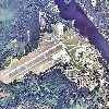 |
By United States Geological Survey (USGS) - USGS via TopoQuesthttp://www.topoquest.com/map.php?lat=44.45413&lon=-83.37994&datum=nad83&zoom=8&map=sat1m&coord=d&mode=zoomout&size=l, Public Domain, https://commons.wikimedia.org/w/index.php?curid=172934 |
Airport Oscoda-Wurtsmith Airport (KOSC) |
|
| 5740 |
6444 |
bali |
2018-05-25 21:15:39 |
 |
By United States Geological Survey (USGS) - USGS The National Map, via MSR Maps (formerly TerraServer-USA), Public Domain, https://commons.wikimedia.org/w/index.php?curid=3937526 |
Airport Orlando Executive Airport (KORL) |
|
| 5741 |
6443 |
bali |
2018-05-25 21:15:29 |
 |
By Eric Salard - ORE ORANGE AIRPORT MA FLIGHT CDG-IAD F-GSPC, CC BY-SA 2.0, https://commons.wikimedia.org/w/index.php?curid=29389015 |
Airport Orange Municipal Airport (KORE) |
|
| 5742 |
6442 |
bali |
2018-05-25 21:15:18 |
 |
By United States Geological Survey (USGS) - USGS via Topoquest URL = https://www.topoquest.com/map.php?lat=39.99015&lon=-75.58129&datum=nad27&zoom=1&map=sat1m&coord=d&mode=zoomin&size=xl, Public Domain, https://commons.wikimedia.org/w/index.php?curi |
Airport Brandywine Airport (KOQN) |
|
| 5743 |
6441 |
bali |
2018-05-25 21:15:06 |
 |
By Vmzp85 - Own work, CC BY-SA 4.0, https://commons.wikimedia.org/w/index.php?curid=64427385 |
Airport Ontario International Airport (KONT) |
|
| 5744 |
6440 |
bali |
2018-05-25 21:14:57 |
 |
By TedQuackenbush - Own work, CC BY-SA 3.0, https://commons.wikimedia.org/w/index.php?curid=20975586 |
Airport Ontario Municipal Airport (KONO) |
|
| 5745 |
6439 |
bali |
2018-05-25 21:14:48 |
 |
By Jonathunder - Own work, GFDL 1.2, https://commons.wikimedia.org/w/index.php?curid=15887611 |
Airport Winona Municipal Airport (KONA) |
|
| 5746 |
6438 |
bali |
2018-05-25 21:14:40 |
 |
By United States Geological Survey (USGS) - USGS The National Map, via MSR Maps (formerly TerraServer-USA)http://msrmaps.com/map.aspx?t=1&s=12&lat=29.300513845&lon=-81.1136164875&w=800&h=800, Public Domain, https://commons.wikimedia.org/w/index.php? |
Airport Ormond Beach Municipal Airport (KOMN) |
|
| 5747 |
6437 |
bali |
2018-05-25 21:14:27 |
 |
By United States Geological Survey (USGS) - USGS via TopoQuest: Topoquest, Public Domain, https://commons.wikimedia.org/w/index.php?curid=24548908 |
Airport Omak Airport (KOMK) |
|
| 5748 |
6436 |
bali |
2018-05-25 21:14:17 |
 |
By Ser Amantio di Nicolao - Own work, CC BY-SA 4.0, https://commons.wikimedia.org/w/index.php?curid=58196955 |
Airport Orange County Airport (Virginia) (KOMH) |
|
| 5749 |
6435 |
bali |
2018-05-25 21:14:08 |
 |
By United States Geological Survey (USGS) - USGS via TopoQuesthttp://www.topoquest.com/map.php?lat=46.96944&lon=-122.90250&datum=nad83&zoom=4&map=sat1m&coord=d&mode=zoomin&size=l, Public Domain, https://commons.wikimedia.org/w/index.php?curid=195575 |
Airport Olympia Regional Airport (KOLM) |
|
| 5750 |
6434 |
bali |
2018-05-25 21:13:55 |
 |
By United States Geological Survey (USGS) - USGS The National Map, via MSR Maps (formerly TerraServer-USA)http://msrmaps.com/map.aspx?t=1&s=12&lat=35.668056&lon=-95.948611&w=600&h=800, Public Domain, https://commons.wikimedia.org/w/index.php?curid=9 |
Airport Okmulgee Regional Airport (KOKM) |
|
|
|
|
|
|
|
|
|
| # |
ID
|
Uploaded by
|
Uploaded on
|
Picture
|
Description
|
Related item(s)
|
|