Pictures
| # |
ID


|
Uploaded by
|
Uploaded on

|
Picture
|
Description
|
Related item(s)
|


|
| 5776 |
6408 |
 bali |
2018-05-25 21:09:28 |
 |
By PH2 Bruce Trombecky - This Image was released by the United States Navy with the ID DN-ST-97-01696 (next).This tag does not indicate the copyright status of the attached work. A normal copyright tag is still required. See Commons:Licensing for mo |
Airport Naval Air Station Joint Reserve Base Fort Worth (KNFW) |
|
| 5777 |
6407 |
bali |
2018-05-25 21:09:16 |
 |
By United States Geological Survey (USGS) - USGS digital orthophoto via MSR Maps, Public Domain, https://commons.wikimedia.org/w/index.php?curid=10102929 |
Airport Naval Auxiliary Landing Field Fentress (KNFE) |
|
| 5778 |
6406 |
bali |
2018-05-25 21:09:05 |
 |
By United States Geological Survey (USGS) - USGS digital orthophoto via MSR Maps, Public Domain, https://commons.wikimedia.org/w/index.php?curid=10102823 |
Airport Naval Outlying Field Summerdale (KNFD) |
|
| 5779 |
6405 |
bali |
2018-05-25 21:08:55 |
 |
By United States Geological Survey (USGS) - USGS via TopoQuesthttp://www.topoquest.com/map.php?lat=30.04250&lon=-90.02833&datum=nad83&zoom=4&map=sat1m&coord=d&mode=zoomin&size=l, Public Domain, https://commons.wikimedia.org/w/index.php?curid=1951973 |
Airport Lakefront Airport (KNEW) |
|
| 5780 |
6404 |
bali |
2018-05-25 21:08:42 |
 |
By Famartin - Own work, CC BY-SA 3.0, https://commons.wikimedia.org/w/index.php?curid=20846496 |
Airport Lakehurst Naes (KNEL) |
|
| 5781 |
6403 |
bali |
2018-05-25 21:08:34 |
 |
By Zol87 from Chicago, Illinois, USA - Former Glenview Naval Air Station Tower, CC BY-SA 2.0, https://commons.wikimedia.org/w/index.php?curid=16313013 |
Airport Naval Air Station Glenview (KNBU) |
|
| 5782 |
6402 |
bali |
2018-05-25 21:08:24 |
 |
By United States Geological Survey - USGS via TopoQuest, Public Domain, https://commons.wikimedia.org/w/index.php?curid=17353074 |
Airport Pinal Airpark (KMZJ) |
|
| 5783 |
6401 |
bali |
2018-05-25 21:08:14 |
 |
By United States Geological Survey (USGS) - USGS via TopoQuesthttp://www.topoquest.com/map.php?lat=39.09777&lon=-121.56982&datum=nad83&zoom=4&map=sat1m&coord=d&mode=zoomin&size=l, Public Domain, https://commons.wikimedia.org/w/index.php?curid=172159 |
Airport Yuba County Airport (KMYV) |
|
| 5784 |
6400 |
bali |
2018-05-25 21:08:01 |
 |
By Spartan7W - Own work, CC BY-SA 3.0, https://commons.wikimedia.org/w/index.php?curid=17609383 |
Airport McCall Municipal Airport (KMYL) |
|
| 5785 |
6399 |
bali |
2018-05-25 21:07:52 |
 |
By Civil Air Patrol - Arkansas Department of Aeronautics, Public Domain, https://commons.wikimedia.org/w/index.php?curid=50949092 |
Airport Manila Municipal Airport (KMXA) |
|
| 5786 |
6398 |
bali |
2018-05-25 21:07:43 |
 |
By United States Geological Survey (USGS) - USGS via TopoQuesthttp://www.topoquest.com/map.php?lat=32.781606&lon=-98.060175&datum=nad83&zoom=4&map=sat1m, Public Domain, https://commons.wikimedia.org/w/index.php?curid=19544098 |
Airport Mineral Wells Airport (KMWL) |
|
| 5787 |
6397 |
bali |
2018-05-25 21:07:30 |
 |
Public Domain, https://commons.wikimedia.org/w/index.php?curid=3709918 |
Airport Grant County International Airport (KMWH) |
|
| 5788 |
6396 |
bali |
2018-05-25 21:07:22 |
 |
By United States Department of Agriculture (USDA), Farm Services Agency - National Agriculture Imagery Program (NAIP) Orthoimagery for Zone 16 Alabama State Quarter Quadrangle EXCEL, NW and I.D. # n_3108738_nw_16_1_20060916.tif, Public Domain, https |
Airport Monroe County Airport (Alabama) (KMVC) |
|
| 5789 |
6395 |
bali |
2018-05-25 21:07:09 |
 |
By United States Air Force - http://www.mountainhome.af.mil/shared/media/photodb/photos/030624-F-8833H-050.jpg, Public Domain, https://commons.wikimedia.org/w/index.php?curid=7688905 |
Airport Mountain Home AFB (KMUO) |
|
| 5790 |
6394 |
bali |
2018-05-25 21:06:58 |
 |
By United States Geological Survey (USGS) - USGS The National Map, via MSR Maps (formerly TerraServer-USA)http://msrmaps.com/map.aspx?t=1&s=12&lon=-83.7040686293204&lat=31.1521003895257&w=800&h=800, Public Domain, https://commons.wikimedia.org/w/ind |
Airport Spence Airport (KMUL) |
|
| 5791 |
6393 |
bali |
2018-05-25 21:06:45 |
 |
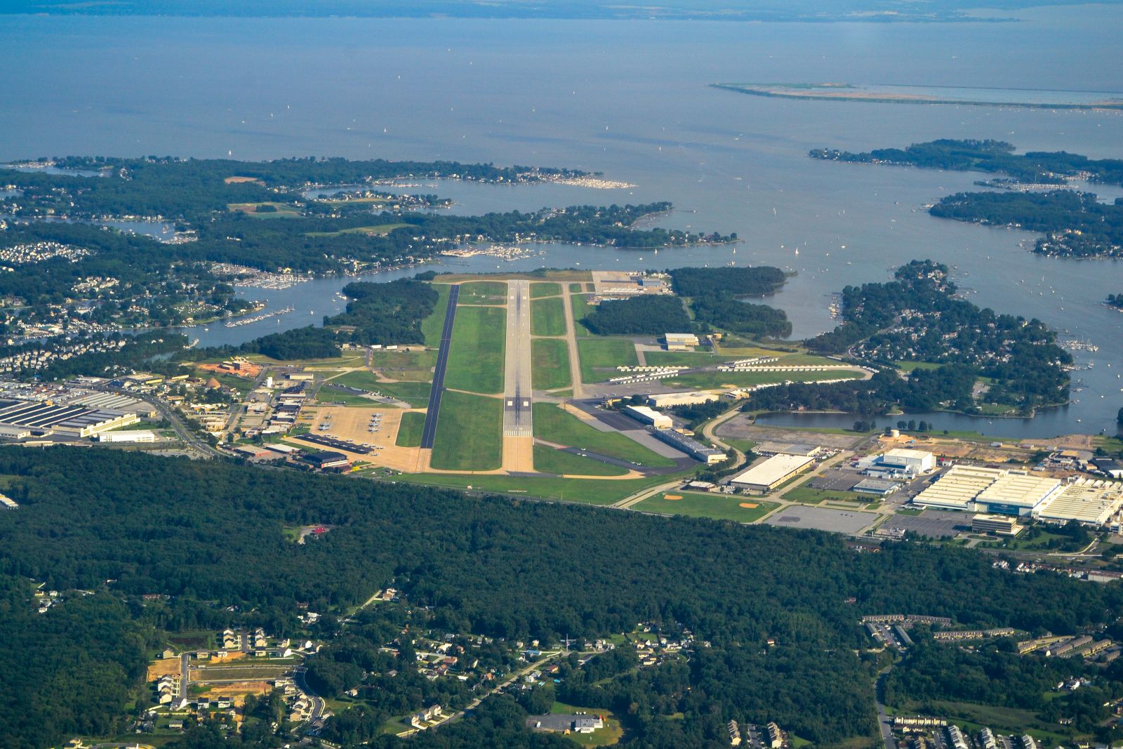
By Aharrin1, CC BY-SA 3.0, https://commons.wikimedia.org/w/index.php?curid=40763883 |
Airport Martin State Airport (KMTN) |
|
| 5792 |
6392 |
bali |
2018-05-25 21:06:37 |
 |
By JKBrooks85 - Own work, Public Domain, https://commons.wikimedia.org/w/index.php?curid=4475007 |
Airport Florida Keys Marathon Airport (KMTH) |
|
| 5793 |
6391 |
bali |
2018-05-25 21:06:29 |
 |
By USAF photo by MSgt. Terry Atwell - U.S. Air Force photo 101014-F-3495A-130 from the 127th Wing website, Public Domain, https://commons.wikimedia.org/w/index.php?curid=11949225 |
Airport Selfridge Angb (KMTC) |
|
| 5794 |
6390 |
bali |
2018-05-25 21:06:18 |
 |
By United States Department of Agriculture (USDA), Farm Services Agency - National Agriculture Imagery Program (NAIP) Orthoimagery for Zone 16 Alabama State Quarter Quadrangle FLORENCE, SE and I.D. # n_3408711_se_16_1_20060620.tif, Public Domain, ht |
Airport Northwest Alabama Regional Airport (KMSL) |
|
| 5795 |
6389 |
bali |
2018-05-25 21:06:05 |
 |
By Bradley Bormuth - Own work, CC BY-SA 3.0 us, https://commons.wikimedia.org/w/index.php?curid=5141841 |
Airport Foothills Regional Airport (KMRN) |
|
| 5796 |
6388 |
bali |
2018-05-25 21:05:56 |
 |
By NDoran2017 - Own work, CC BY-SA 4.0, https://commons.wikimedia.org/w/index.php?curid=58462454 |
Airport Eastern WV Regional Airport (KMRB) |
|
| 5797 |
6387 |
bali |
2018-05-25 21:05:47 |
 |
By United States Geological Survey (USGS) - USGS The National Map, via MSR Maps (formerly TerraServer-USA), Public Domain, https://commons.wikimedia.org/w/index.php?curid=7002669 |
Airport Smyrna Airport (Tennessee) (KMQY) |
|
| 5798 |
6386 |
bali |
2018-05-25 21:05:36 |
 |
By State of Vermont - http://aviation.vermont.gov/airports/efknapp, Public Domain, https://commons.wikimedia.org/w/index.php?curid=33470199 |
Airport Edward F. Knapp State Airport (KMPV) |
|
| 5799 |
6385 |
bali |
2018-05-25 21:05:26 |
 |
By Don Ramey Logan - Own work, CC BY-SA 4.0, https://commons.wikimedia.org/w/index.php?curid=38783045 |
Airport Mariposa-Yosemite Airport (KMPI) |
|
| 5800 |
6384 |
bali |
2018-05-25 21:05:18 |
 |
By Don Ramey Logan - Own work, CC BY 4.0, https://commons.wikimedia.org/w/index.php?curid=39453362 |
Airport Modesto City-County Airport (KMOD) |
|
|
|
|
|
|
|
|
|
| # |
ID
|
Uploaded by
|
Uploaded on
|
Picture
|
Description
|
Related item(s)
|
|