Pictures
| # |
ID


|
Uploaded by
|
Uploaded on

|
Picture
|
Description
|
Related item(s)
|


|
| 5851 |
6333 |
 bali |
2018-05-25 20:55:47 |
 |
By United States Geological Survey (USGS) - USGS The National Map, via MSR Maps (formerly TerraServer-USA)http://msrmaps.com/map.aspx?t=1&s=12&lon=-92.206965&lat=34.729463&w=800&h=800, Public Domain, https://commons.wikimedia.org/w/index.php?curid=3 |
Airport Clinton National Airport (KLIT) |
|
| 5852 |
6332 |
bali |
2018-05-25 20:55:33 |
 |
By United States Geological Survey (USGS) - USGS via GPS Visualizer websitehttp://www.gpsvisualizer.com/map_input?special=wikipedia&format=google&bg_map=usgs_aerial&sp_width=50km&form:data=type,name,latitude,longitude%0DW,%22La%20Junta%20Municipal%2 |
Airport La Junta Municipal Airport (KLHX) |
|
| 5853 |
6331 |
bali |
2018-05-25 20:55:20 |
 |
By US Geological Survey - http://www.topoquest.com/map.php?lat=31.889167&lon=-81.562222&datum=nad83&zoom=4&map=sat1m, Public Domain, https://commons.wikimedia.org/w/index.php?curid=20301847 |
Airport MidCoast Regional Airport at Wright Army Airfield (KLHW) |
|
| 5854 |
6330 |
bali |
2018-05-25 20:55:10 |
 |
By United States Geological Survey (USGS) - USGS via TopoQuesthttp://www.topoquest.com/map.php?lat=38.90917&lon=-121.35139&datum=nad83&zoom=4&map=sat1m&coord=d&mode=zoomin&size=l, Public Domain, https://commons.wikimedia.org/w/index.php?curid=198839 |
Airport Lincoln Regional Airport (California) (KLHM) |
|
| 5855 |
6329 |
bali |
2018-05-25 20:54:56 |
 |
By GoMan195531 - I took this photo while driving near Logan-Cache Airport, capturing a picture of the entrance of the airport. I used an iPhone in order to capture the photoPreviously published: Google+, https://plus.google.com/u/0/10148881472586224 |
Airport Logan-Cache Airport (KLGU) |
|
| 5856 |
6328 |
bali |
2018-05-25 20:54:44 |
 |
By Marines from Arlington, VA, United States Lance Cpl. Anabel Abreu Rodriguez/Marine Corps Air Station Yuma Combat Camera - Layover, Public Domain, https://commons.wikimedia.org/w/index.php?curid=48050999 |
Airport Laguna Army Airfield (KLGF) |
|
| 5857 |
6327 |
bali |
2018-05-25 20:54:33 |
 |
By Visitor7 - Own work, CC BY-SA 3.0, https://commons.wikimedia.org/w/index.php?curid=25553944 |
Airport La Grande/Union County Airport (KLGD) |
|
| 5858 |
6326 |
bali |
2018-05-25 20:54:24 |
 |
By Tech. Sgt. Ben Bloker, United States Air Force - http://www.jble.af.mil/photos/mediagallery.asp?galleryID=1262&?id=-1&page=3&count=48, Public Domain, https://commons.wikimedia.org/w/index.php?curid=15792922 |
Airport Langley AFB (KLFI) |
|
| 5859 |
6325 |
bali |
2018-05-25 20:54:12 |
 |
By Royal Navy official photographer - This is photograph A 26734 from the collections of the Imperial War Museums., Public Domain, https://commons.wikimedia.org/w/index.php?curid=473284 |
Airport Auburn/Lewiston Municipal Airport (KLEW) |
|
| 5860 |
6323 |
bali |
2018-05-25 20:53:49 |
 |
By United States Geological Survey (USGS) - USGS The National Map, via MSR Maps (formerly TerraServer-USA), Public Domain, https://commons.wikimedia.org/w/index.php?curid=3958444 |
Airport Leesburg International Airport (KLEE) |
|
| 5861 |
6322 |
bali |
2018-05-25 20:53:38 |
 |
By Quist - I took it from a Porter flight into EWRPreviously published: Flickr, CC BY-SA 3.0, https://commons.wikimedia.org/w/index.php?curid=38350524 |
Airport Linden Airport (KLDJ) |
|
| 5862 |
6321 |
bali |
2018-05-25 20:53:28 |
 |
Public Domain, https://en.wikipedia.org/w/index.php?curid=16195483 |
Airport Rickenbacker International Airport (KLCK) |
|
| 5863 |
6320 |
bali |
2018-05-25 20:53:21 |
 |
By United States Geological Survey (USGS) - USGS via GPSvisualizer.comhttp://www.gpsvisualizer.com/map_input?special=wikipedia&format=google&bg_map=usgs_aerial&sp_width=50km&form:data=type,name,latitude,longitude%0DW,%22Liberal%20Mid-America%20Regio |
Airport Liberal Mid-America Regional Airport (KLBL) |
|
| 5864 |
6319 |
bali |
2018-05-25 20:53:07 |
 |
By Canadian2006 - Own work, CC BY-SA 3.0, https://commons.wikimedia.org/w/index.php?curid=16505597 |
Airport Arnold Palmer Regional Airport (KLBE) |
|
| 5865 |
6318 |
bali |
2018-05-25 20:52:59 |
 |
By United States Geological Survey (USGS) - USGS via GPS Visualizer websitehttp://www.gpsvisualizer.com/map_input?special=wikipedia&format=google&bg_map=usgs_aerial&sp_width=50km&form:data=type,name,latitude,longitude%0DW,%22Lubbock%20Preston%20Smit |
Airport Lubbock Preston Smith International Airport (KLBB) |
|
| 5866 |
6317 |
bali |
2018-05-25 20:52:46 |
 |
By Source (WP:NFCC#4), Fair use, https://en.wikipedia.org/w/index.php?curid=54241413 |
Airport Laramie Regional Airport (KLAR) |
|
| 5867 |
6316 |
bali |
2018-05-25 20:52:38 |
 |
By N419BH - Own work, CC BY-SA 3.0, https://commons.wikimedia.org/w/index.php?curid=12240144 |
Airport Purdue University Airport (KLAF) |
|
| 5868 |
6315 |
bali |
2018-05-25 20:52:30 |
 |
By United States Geological Survey (USGS) - USGS via TopoQuesthttp://www.topoquest.com/map.php?lat=36.22654&lon=-121.12216&datum=nad83&zoom=4&map=sat1m&coord=d&mode=pan&size=m, Public Domain, https://commons.wikimedia.org/w/index.php?curid=19908458 |
Airport Mesa Del Rey Airport (KKIC) |
|
| 5869 |
6314 |
bali |
2018-05-25 20:52:17 |
 |
By United States Geological Survey (USGS) - USGS via TopoQuesthttp://www.topoquest.com/map.php?lat=32.69951&lon=-80.00489&datum=nad83&zoom=4&map=sat1m&coord=d&mode=pan&size=l, Public Domain, https://commons.wikimedia.org/w/index.php?curid=19518295 |
Airport Charleston Executive Airport (KJZI) |
|
| 5870 |
6313 |
bali |
2018-05-25 20:52:04 |
 |
By Larry D. Moore, CC BY-SA 3.0, https://commons.wikimedia.org/w/index.php?curid=35424192 |
Airport Mid-Way Regional Airport (KJWY) |
|
| 5871 |
6312 |
bali |
2018-05-25 20:51:56 |
 |
By United States Geological Survey (USGS) - USGS The National Map, via MSR Maps (formerly TerraServer-USA), Public Domain, https://commons.wikimedia.org/w/index.php?curid=4012840 |
Airport John C. Tune Airport (KJWN) |
|
| 5872 |
6311 |
bali |
2018-05-25 20:51:44 |
 |
By Bedford at en.wikipedia - Own workTransferred from en.wikipedia, Public Domain, https://commons.wikimedia.org/w/index.php?curid=18059407 |
Airport Clark Regional Airport (KJVY) |
|
| 5873 |
6310 |
bali |
2018-05-25 20:51:35 |
 |
By United States Geological Survey (USGS) - USGS via TopoQuesthttp://www.topoquest.com/map.php?lat=32.304444&lon=-90.410556&datum=nad83&zoom=4&map=sat1m, Public Domain, https://commons.wikimedia.org/w/index.php?curid=20085200 |
Airport John Bell Williams Airport (KJVW) |
|
| 5874 |
6309 |
bali |
2018-05-25 20:51:23 |
 |
By United States Geological Survey (USGS) - USGS via TopoQuesthttp://www.topoquest.com/map.php?lat=42.62028&lon=-89.04167&datum=nad83&zoom=4&map=sat1m&coord=d&mode=zoomin&size=l, Public Domain, https://commons.wikimedia.org/w/index.php?curid=1994253 |
Airport Southern Wisconsin Regional Airport (KJVL) |
|
| 5875 |
6308 |
bali |
2018-05-25 20:51:10 |
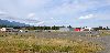 |
By Finetooth - Own work, CC BY-SA 3.0, https://commons.wikimedia.org/w/index.php?curid=11597482 |
Airport Joseph State Airport (KJSY) |
|
|
|
|
|
|
|
|
|
| # |
ID
|
Uploaded by
|
Uploaded on
|
Picture
|
Description
|
Related item(s)
|
|


