Pictures
| # |
ID


|
Uploaded by
|
Uploaded on

|
Picture
|
Description
|
Related item(s)
|


|
| 5876 |
6307 |
 bali |
2018-05-25 20:51:02 |
 |
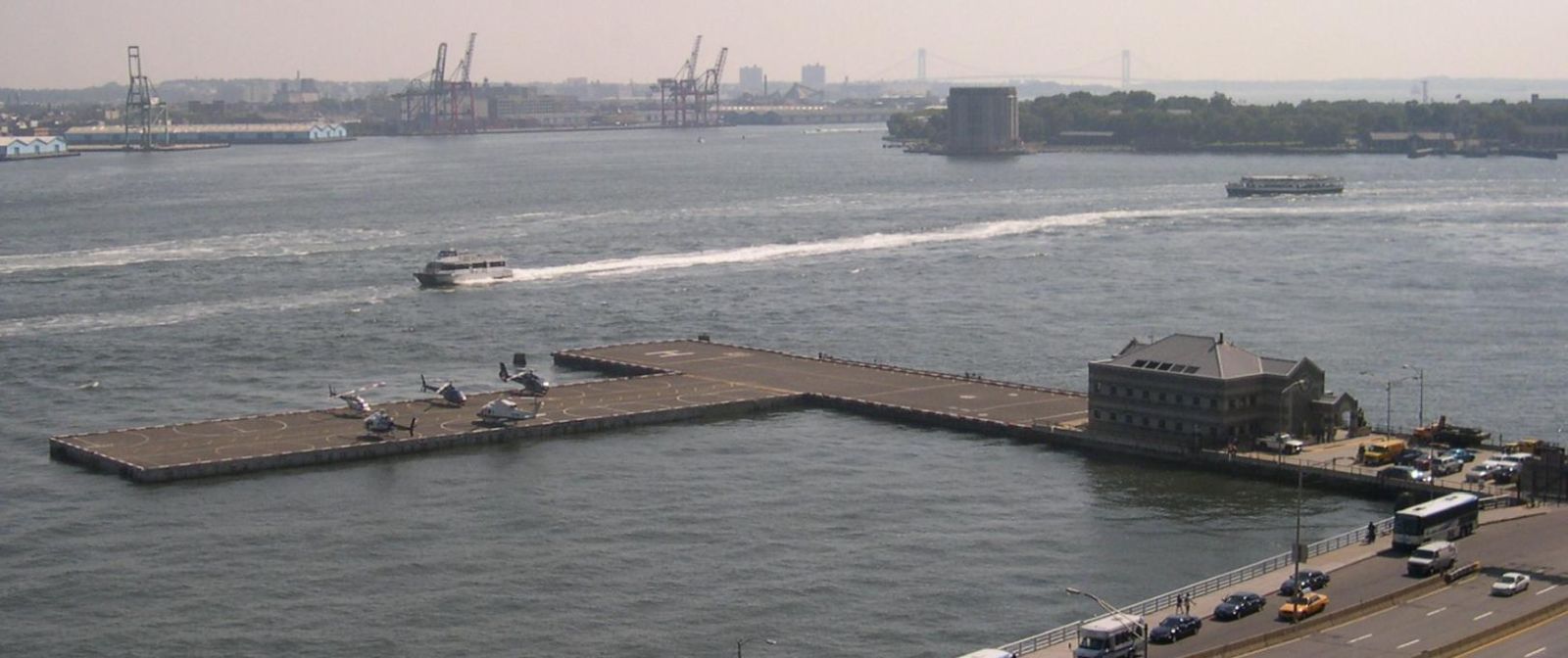
By Original uploader was Sfoskett at en.wikipedia - Transferred from en.wikipedia to Commons by Niklem., CC BY-SA 3.0, https://commons.wikimedia.org/w/index.php?curid=20768872 |
Airport Downtown Manhattan Heliport (KJRB) |
|
| 5877 |
6306 |
bali |
2018-05-25 20:50:51 |
 |
By Americasroof - Own work, CC BY-SA 3.0, https://commons.wikimedia.org/w/index.php?curid=7533579 |
Airport West 30th Street Heliport (KJRA) |
|
| 5878 |
6305 |
bali |
2018-05-25 20:50:43 |
 |
By United States Department of Agriculture (USDA), Farm Services Agency - National Agriculture Imagery Program (NAIP) Orthoimagery for Zone 16 Alabama State Quarter Quadrangle GULF SHORES, SW and I.D. # n_3008743_sw_16_1_20061109.tif, Public Domain, |
Airport Jack Edwards Airport (KJKA) |
|
| 5879 |
6304 |
bali |
2018-05-25 20:50:29 |
 |
By United States Department of Agriculture (USDA), Farm Services Agency - National Agriculture Imagery Program (NAIP) Orthoimagery for Zone 16 Alabama State Quarter Quadrangle EUFAULA NORTH, NE and I.D. # n_3108507_ne_16_1_20060624.tif, Public Domai |
Airport Walker County Airport (KJFX) |
|
| 5880 |
6303 |
bali |
2018-05-25 20:50:16 |
 |
By Civil Air Patrol - Arkansas Department of Aeronautics, Public Domain, https://commons.wikimedia.org/w/index.php?curid=50948942 |
Airport Jonesboro Municipal Airport (KJBR) |
|
| 5881 |
6302 |
bali |
2018-05-25 20:50:07 |
 |
CC BY 2.5, https://en.wikipedia.org/w/index.php?curid=10036260 |
Airport New Century AirCenter (KIXD) |
|
| 5882 |
6301 |
bali |
2018-05-25 20:50:00 |
 |
By WhisperToMe - Own work, CC0, https://commons.wikimedia.org/w/index.php?curid=15619696 |
Airport West Houston Airport (KIWS) |
|
| 5883 |
6300 |
bali |
2018-05-25 20:49:51 |
 |
By Fk - Own work, CC BY-SA 3.0, https://commons.wikimedia.org/w/index.php?curid=8542341 |
Airport Ithaca Tompkins Regional Airport (KITH) |
|
| 5884 |
6299 |
bali |
2018-05-25 20:49:43 |
 |
By Nyttend - Own work, Public Domain, https://commons.wikimedia.org/w/index.php?curid=4593874 |
Airport Cincinnati-Blue Ash Airport (KISZ) |
|
| 5885 |
6298 |
bali |
2018-05-25 20:49:34 |
 |
By United States Geogolical Suvey - USGS via TopoQuesthttp://www.topoquest.com/map.php?lat=35.32726&lon=-77.61641&datum=nad83&zoom=8&map=sat1m&coord=d&mode=zoomin&size=l, Public Domain, https://commons.wikimedia.org/w/index.php?curid=17377838 |
Airport Kinston Regional Jetport (KISO) |
|
| 5886 |
6297 |
bali |
2018-05-25 20:49:21 |
 |
By Darwininan - Own work, CC BY-SA 3.0, https://commons.wikimedia.org/w/index.php?curid=4836225 |
Airport Kissimmee Gateway Airport (KISM) |
|
| 5887 |
6296 |
bali |
2018-05-25 20:49:12 |
 |
By DeAllenWeten - Own work, CC BY-SA 4.0, https://commons.wikimedia.org/w/index.php?curid=60783463 |
Airport Williamsport Regional Airport (KIPT) |
|
| 5888 |
6295 |
bali |
2018-05-25 20:49:04 |
 |
By United States Geological Survey (USGS) - USGS via TopoQuesthttp://www.topoquest.com/map.php?lat=35.02194&lon=-110.72250&datum=nad83&zoom=4&map=sat1m&coord=d&mode=zoomin&size=l, Public Domain, https://commons.wikimedia.org/w/index.php?curid=195248 |
Airport Winslow-Lindbergh Regional Airport (KINW) |
|
| 5889 |
6294 |
bali |
2018-05-25 20:48:51 |
 |
By Caholguin109 - Own work, CC BY-SA 4.0, https://commons.wikimedia.org/w/index.php?curid=64304208 |
Airport Smith Reynolds Airport (KINT) |
|
| 5890 |
6293 |
bali |
2018-05-25 20:48:43 |
 |
By Doc Searls from Santa Barbara, USA - 2010_08_06_rno-phx-bos_075Uploaded by PDTillman, CC BY 2.0, https://commons.wikimedia.org/w/index.php?curid=16951374 |
Airport Indian Springs Af Aux (KINS) |
|
| 5891 |
6292 |
bali |
2018-05-25 20:48:32 |
 |
By United States Geological Survey (USGS) - USGS via TopoQuesthttp://www.topoquest.com/map.php?lat=31.779628&lon=-103.201362&datum=nad83&zoom=4&map=sat1m, Public Domain, https://commons.wikimedia.org/w/index.php?curid=19545984 |
Airport Winkler County Airport (KINK) |
|
| 5892 |
6291 |
bali |
2018-05-25 20:48:20 |
 |
By US Geological Survey - http://www.topoquest.com/map.php?lat=26.42853&lon=-81.40332&datum=nad83&zoom=4&map=sat1m&coord=d&mode=pan&size=l, Public Domain, https://commons.wikimedia.org/w/index.php?curid=20517493 |
Airport Immokalee Regional Airport (KIMM) |
|
| 5893 |
6290 |
bali |
2018-05-25 20:48:09 |
 |
By Ildar Sagdejev (Specious) - Own work, CC BY-SA 3.0, https://commons.wikimedia.org/w/index.php?curid=4241148 |
Airport Horace Williams Airport (KIGX) |
|
| 5894 |
6289 |
bali |
2018-05-25 20:48:00 |
 |
By Djcuthbert84 at English Wikipedia, CC BY-SA 3.0, https://commons.wikimedia.org/w/index.php?curid=66016486 |
Airport Lansing Municipal Airport (KIGQ) |
|
| 5895 |
6288 |
bali |
2018-05-25 20:47:51 |
 |
By US Geological Survey - Source: US Geological Survey, Public Domain, https://commons.wikimedia.org/w/index.php?curid=56886123 |
Airport Kingman Airport (Arizona) (KIGM) |
|
| 5896 |
6287 |
bali |
2018-05-25 20:47:42 |
 |
By United States Geological Survey (USGS) - USGS via GPS Visualizer websitehttp://www.gpsvisualizer.com/map_input?special=wikipedia&format=google&bg_map=usgs_aerial&sp_width=50km&form:data=type,name,latitude,longitude%0DW,%22Independence%20Municipal |
Airport Independence Municipal Airport (Kansas) (KIDP) |
|
| 5897 |
6286 |
bali |
2018-05-25 20:47:28 |
 |
By United States Geological Survey (USGS) - USGS via TopoQuesthttp://www.topoquest.com/map.php?lat=33.48556&lon=-90.67889&datum=nad83&zoom=4&map=sat1m&coord=d&mode=zoomin&size=l, Public Domain, https://commons.wikimedia.org/w/index.php?curid=2006994 |
Airport Indianola Municipal Airport (KIDL) |
|
| 5898 |
6285 |
bali |
2018-05-25 20:47:15 |
 |
By Rdore at English Wikipedia - I (Rdore) took this photo., Public Domain, https://commons.wikimedia.org/w/index.php?curid=55688372 |
Airport Idaho Falls Regional Airport (KIDA) |
|
| 5899 |
6284 |
bali |
2018-05-25 20:47:05 |
 |
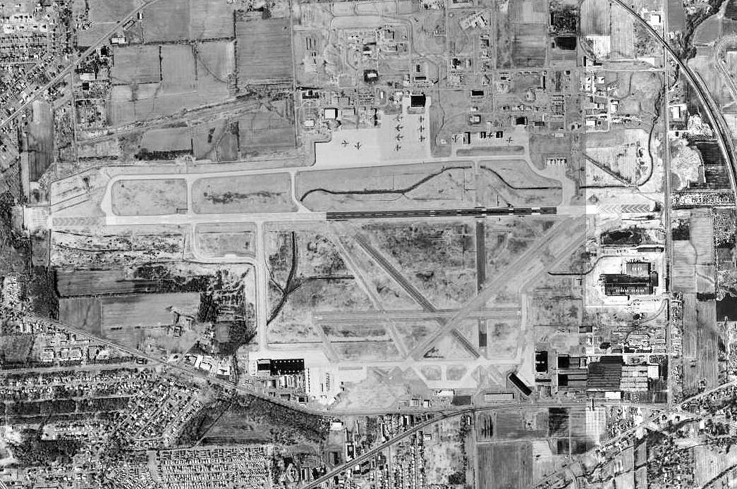
By United States Geological Survey (USGS) - USGS The National Map, via MSR Maps (formerly TerraServer-USA)http://msrmaps.com/map.aspx?t=1&s=12&lon=-78.9475&lat=43.113333&w=600&h=400, Public Domain, https://commons.wikimedia.org/w/index.php?curid=140 |
Airport Niagara Falls International Airport (KIAG) |
|
| 5900 |
6283 |
bali |
2018-05-25 20:46:52 |
 |
By http://www.mcconnell.af.mil/shared/media/photodb/photos/070805-F-0996S-051.jpg, Public Domain, https://commons.wikimedia.org/w/index.php?curid=3728584 |
Airport McConnell Air Force Base (KIAB) |
|
|
|
|
|
|
|
|
|
| # |
ID
|
Uploaded by
|
Uploaded on
|
Picture
|
Description
|
Related item(s)
|
|