Pictures
| # |
ID


|
Uploaded by
|
Uploaded on

|
Picture
|
Description
|
Related item(s)
|


|
| 5951 |
6232 |
 bali |
2018-05-25 20:37:44 |
 |
By United States Geological Survey (USGS) - USGS via TopoQuesthttp://topoquest.com/map.php?lat=28.062778&lon=-81.753333&datum=nad83&zoom=4&map=sat1m, Public Domain, https://commons.wikimedia.org/w/index.php?curid=20360583 |
Airport Winter Haven's Gilbert Airport (KGIF) |
|
| 5952 |
6231 |
bali |
2018-05-25 20:37:32 |
 |
By United States Geological Survey (USGS) - USGS via TopoQuesthttp://www.topoquest.com/map.php?lat=48.21928&lon=-106.61719&datum=nad83&zoom=4&map=sat1m&coord=d&mode=pan&size=l, Public Domain, https://commons.wikimedia.org/w/index.php?curid=19525578 |
Airport Glasgow Airport (U.S.) (KGGW) |
|
| 5953 |
6230 |
bali |
2018-05-25 20:37:20 |
 |
By United States Geological Survey (USGS) - USGS The National Map, via MSR Maps (formerly TerraServer-USA), Public Domain, https://commons.wikimedia.org/w/index.php?curid=6526956 |
Airport Georgetown County Airport (KGGE) |
|
| 5954 |
6229 |
bali |
2018-05-25 20:37:09 |
 |
By JBC3 - Own work, Public Domain, https://commons.wikimedia.org/w/index.php?curid=6974802 |
Airport Floyd Bennett Memorial Airport (KGFL) |
|
| 5955 |
6228 |
bali |
2018-05-25 20:37:01 |
 |
By Aspengull - Own work, CC BY 3.0, https://commons.wikimedia.org/w/index.php?curid=7505398 |
Airport Grand Forks International Airport (KGFK) |
|
| 5956 |
6227 |
bali |
2018-05-25 20:36:53 |
 |
By Unietd States Air Force - Scan of photo from Malmstrom AFB Official base guide, Public Domain, https://commons.wikimedia.org/w/index.php?curid=9392814 |
Airport Great Falls (KGFA) |
|
| 5957 |
6226 |
bali |
2018-05-25 20:36:43 |
 |
By Daniel Piotrowski - http://www.airliners.net/photo//1178919/L/, GFDL 1.2, https://commons.wikimedia.org/w/index.php?curid=17300971 |
Airport Montgomery County Airpark (KGAI) |
|
| 5958 |
6225 |
bali |
2018-05-25 20:36:33 |
 |
By United States Department of Agriculture (USDA), Farm Services Agency - National Agriculture Imagery Program (NAIP) Orthoimagery for Zone 16 Alabama State Quarter Quadrangle STEELE, NE and I.D. # n_3308607_ne_16_1_20060621.tif, Public Domain, http |
Airport Northeast Alabama Regional Airport (KGAD) |
|
| 5959 |
6224 |
bali |
2018-05-25 20:36:20 |
 |
By Brandonrush - Own work, CC BY-SA 3.0, https://commons.wikimedia.org/w/index.php?curid=26836767 |
Airport Drake Field (KFYV) |
|
| 5960 |
6223 |
bali |
2018-05-25 20:36:11 |
 |
By Mobilus In Mobili - Autumn Airport, CC BY-SA 2.0, https://commons.wikimedia.org/w/index.php?curid=53906768 |
Airport Sussex Airport (New Jersey) (KFWN) |
|
| 5961 |
6222 |
bali |
2018-05-25 20:36:02 |
 |
By United States Geological Survey (USGS) - USGS The National Map, via MSR Maps (formerly TerraServer-USA)Interactive map: http://msrmaps.com/map.aspx?t=4&s=12&lat=40.9794&lon=-85.1991&w=1000&h=1000Image: http://msrmaps.com/GetImageArea.ashx?t=4&s=1 |
Airport Fort Wayne International Airport (KFWA) |
|
| 5962 |
6221 |
bali |
2018-05-25 20:35:49 |
 |
By United States Geological Survey (USGS) - USGS The National Map, via MSR Maps (formerly TerraServer-USA)http://msrmaps.com/map.aspx?t=1&s=12&lon=-85.972222&lat=37.906944&w=800&h=800, Public Domain, https://commons.wikimedia.org/w/index.php?curid=9 |
Airport Godman Army Airfield (KFTK) |
|
| 5963 |
6220 |
bali |
2018-05-25 20:35:36 |
 |
By United States Geological Survey (USGS) - USGS via GPS Visualizer websitehttp://www.gpsvisualizer.com/map_input?special=wikipedia&format=google&bg_map=usgs_aerial&sp_width=50km&form:data=type,name,latitude,longitude%0DW,%22Fort%20Sumner%20Municipa |
Airport Fort Sumner Municipal Airport (KFSU) |
|
| 5964 |
6219 |
bali |
2018-05-25 20:35:23 |
 |
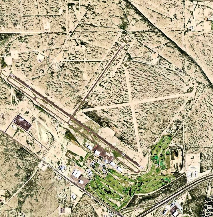
By United States Geological Survey (USGS) - USGS via TopoQuesthttp://www.topoquest.com/map.php?lat=30.91525&lon=-102.91278&datum=nad83&zoom=4&map=sat1m&coord=d&mode=zoomin&size=l, Public Domain, https://commons.wikimedia.org/w/index.php?curid=195432 |
Airport Fort Stockton-Pecos County Airport (KFST) |
|
| 5965 |
6218 |
bali |
2018-05-25 20:35:10 |
 |
By Civil Air Patrol - Arkansas Department of Aeronautics, Public Domain, https://commons.wikimedia.org/w/index.php?curid=30319541 |
Airport Fort Smith Regional Airport (KFSM) |
|
| 5966 |
6217 |
bali |
2018-05-25 20:35:00 |
 |
By http://www.topoquest.com/map.php?lat=34.64972&lon=-98.40222&datum=nad83&zoom=4&map=sat1m&coord=d&mode=zoomin&size=l - http://www.topoquest.com/map.php?lat=34.64972&lon=-98.40222&datum=nad83&zoom=4&map=sat1m&coord=d&mode=zoomin&size=l, Public Doma |
Airport Henry Post Army Airfield (KFSI) |
|
| 5967 |
6216 |
bali |
2018-05-25 20:34:47 |
 |
By United States Geological Survey (USGS) - USGS via GPS Visualizer websitehttp://www.gpsvisualizer.com/map_input?special=wikipedia&format=google&bg_map=usgs_aerial&sp_width=50km&form:data=type,name,latitude,longitude%0DW,%22Marshall%20Army%20Airfie |
Airport Marshall Aaf (KFRI) |
|
| 5968 |
6215 |
bali |
2018-05-25 20:34:34 |
 |
By Ellin Beltz - Own work, Public Domain, https://commons.wikimedia.org/w/index.php?curid=29677339 |
Airport Rohnerville Airport (KFOT) |
|
| 5969 |
6214 |
bali |
2018-05-25 20:34:26 |
 |
By United States Geological Survey (USGS) - USGS orthophoto via MSR Maps (formerly TerraServer-USA), Public Domain, https://commons.wikimedia.org/w/index.php?curid=4966441 |
Airport Francis S. Gabreski Airport (KFOK) |
|
| 5970 |
6213 |
bali |
2018-05-25 20:34:15 |
 |
By United States Geological Survey (USGS) - USGS via TopoQuesthttp://www.topoquest.com/map.php?lat=40.586111&lon=-97.573056&datum=nad83&zoom=4&map=sat1m, Public Domain, https://commons.wikimedia.org/w/index.php?curid=19577838 |
Airport Fairmont State Airfield (KFMZ) |
|
| 5971 |
6212 |
bali |
2018-05-25 20:34:04 |
 |
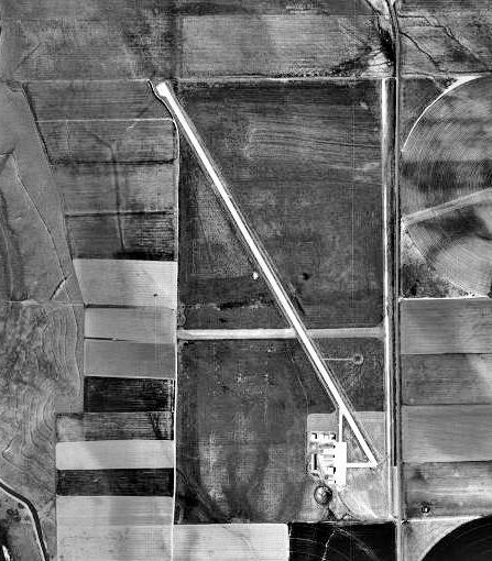
By United States Geological Survey (USGS) - USGS The National Map, via MSR Maps (formerly TerraServer-USA)http://msrmaps.com/map.aspx?t=1&s=12&lon=-103.804167&lat=40.333889&w=600&h=800, Public Domain, https://commons.wikimedia.org/w/index.php?curid= |
Airport Fort Morgan Municipal Airport (KFMM) |
|
| 5972 |
6211 |
bali |
2018-05-25 20:33:50 |
 |
By Aharrin1 - Own work, CC BY-SA 3.0, https://commons.wikimedia.org/w/index.php?curid=31528827 |
Airport Tipton Airport (KFME) |
|
| 5973 |
6210 |
bali |
2018-05-25 20:33:42 |
 |
By United States Geological Survey (USGS) - USGS via GPSvisualizer.comhttp://www.gpsvisualizer.com/map_input?special=wikipedia&format=google&bg_map=usgs_aerial&sp_width=50km&form:data=type,name,latitude,longitude%0DW,%22Sherman%20Army%20Airfield%22, |
Airport Sherman Aaf (KFLV) |
|
| 5974 |
6209 |
bali |
2018-05-25 20:33:29 |
 |
By Pro-Zak - https://www.flickr.com/photos/vogelium/177352354/, CC BY 2.0, https://commons.wikimedia.org/w/index.php?curid=4128414 |
Airport Flushing Airport (KFLU) |
|
| 5975 |
6208 |
bali |
2018-05-25 20:33:20 |
 |
By Civil Air Patrol - Arkansas Department of Aeronautics, Public Domain, https://commons.wikimedia.org/w/index.php?curid=50948524 |
Airport Marion County Regional Airport (KFLP) |
|
|
|
|
|
|
|
|
|
| # |
ID
|
Uploaded by
|
Uploaded on
|
Picture
|
Description
|
Related item(s)
|
|