Pictures
| # |
ID


|
Uploaded by
|
Uploaded on

|
Picture
|
Description
|
Related item(s)
|


|
| 5976 |
6207 |
 bali |
2018-05-25 20:33:11 |
 |
By United States Geological Survey (USGS) - USGS via TopoQuesthttp://www.topoquest.com/map.php?lat=34.18528&lon=-79.72389&datum=nad83&zoom=4&map=sat1m&coord=d&mode=zoomin&size=l, Public Domain, https://commons.wikimedia.org/w/index.php?curid=1951312 |
Airport Florence Regional Airport (KFLO) |
|
| 5977 |
6206 |
bali |
2018-05-25 20:32:58 |
 |
By I, the copyright holder of this work, hereby publish it under the following license: - Own work, CC BY-SA 3.0, https://commons.wikimedia.org/w/index.php?curid=31981792 |
Airport Fond du Lac County Airport (KFLD) |
|
| 5978 |
6205 |
bali |
2018-05-25 20:32:48 |
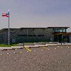 |
By BS2195 - Own work, CC BY-SA 4.0, https://commons.wikimedia.org/w/index.php?curid=58976022 |
Airport Fitchburg Municipal Airport (KFIT) |
|
| 5979 |
6204 |
bali |
2018-05-25 20:32:39 |
 |
By United States Air Force - Photo scanned from Wright-Patterson AFB Guide - www.wpafb.af.mil, Public Domain, https://commons.wikimedia.org/w/index.php?curid=11311471 |
Airport Wright Patterson AFB (KFFO) |
|
| 5980 |
6203 |
bali |
2018-05-25 20:32:28 |
 |
Public Domain, https://commons.wikimedia.org/w/index.php?curid=1044370 |
Airport Francis E. Warren Air Force Base (KFEW) |
|
| 5981 |
6202 |
bali |
2018-05-25 20:32:20 |
 |
By Nyttend - Own work, Public Domain, https://commons.wikimedia.org/w/index.php?curid=2414585 |
Airport Findlay Airport (KFDY) |
|
| 5982 |
6201 |
bali |
2018-05-25 20:32:12 |
 |
By United States Geological Survey (USGS) - USGS via GPS Visualizer websitehttp://www.gpsvisualizer.com/map_input?special=wikipedia&format=google&bg_map=usgs_aerial&sp_width=50km&form:data=type,name,latitude,longitude%0DW,%22Frederick%20Regional%20A |
Airport Frederick Regional Airport (KFDR) |
|
| 5983 |
6200 |
bali |
2018-05-25 20:31:59 |
 |
By FIshstick at English Wikipedia - Own work, Public Domain, https://commons.wikimedia.org/w/index.php?curid=49571801 |
Airport Frederick Municipal Airport (Maryland) (KFDK) |
|
| 5984 |
6199 |
bali |
2018-05-25 20:31:50 |
 |
By Civil Air Patrol - Arkansas Department of Aeronautics, Public Domain, https://commons.wikimedia.org/w/index.php?curid=50948606 |
Airport Forrest City Municipal Airport (KFCY) |
|
| 5985 |
6198 |
bali |
2018-05-25 20:31:39 |
 |
By United States Geological Survey (USGS) - USGS via TopoQuesthttp://www.topoquest.com/map.php?lat=36.732222&lon=-119.820278&datum=nad83&zoom=4&map=sat1m, Public Domain, https://commons.wikimedia.org/w/index.php?curid=19958368 |
Airport Fresno Chandler Executive Airport (KFCH) |
|
| 5986 |
6197 |
bali |
2018-05-25 20:31:27 |
 |
By United States Geological Survey (USGS) - USGS digital orthophoto via MSR Maps (formerly TerraServer-USA), Public Domain, https://commons.wikimedia.org/w/index.php?curid=8056983 |
Airport Simmons Army Airfield (KFBG) |
|
| 5987 |
6196 |
bali |
2018-05-25 20:31:15 |
 |
By Source (WP:NFCC#4), Fair use, https://en.wikipedia.org/w/index.php?curid=38644380 |
Airport Fayetteville Regional Airport (KFAY) |
|
| 5988 |
6195 |
bali |
2018-05-25 20:31:07 |
 |
By United States Geological Survey (USGS) - USGS The National Map, via MSR Maps (formerly TerraServer-USA), Public Domain, https://commons.wikimedia.org/w/index.php?curid=4121077 |
Airport Fresno Yosemite International Airport (KFAT) |
|
| 5989 |
6194 |
bali |
2018-05-25 20:30:56 |
 |
By United States Geological Survey (USGS) - USGS via TopoQuesthttp://www.topoquest.com/map.php?lat=46.91706&lon=-96.81350&datum=nad83&zoom=8&map=sat1m&coord=d&mode=zoomout&size=l, Public Domain, https://commons.wikimedia.org/w/index.php?curid=195558 |
Airport Hector International Airport (KFAR) |
|
| 5990 |
6193 |
bali |
2018-05-25 20:30:42 |
 |
By Jonmkj - Own work, CC BY-SA 3.0, https://commons.wikimedia.org/w/index.php?curid=25267977 |
Airport Heart of Georgia Regional Airport (KEZM) |
|
| 5991 |
6192 |
bali |
2018-05-25 20:30:32 |
 |
By United States Geological Survey (USGS) - USGS The National Map, via MSR Maps (formerly TerraServer-USA)http://msrmaps.com/map.aspx?t=1&s=12&lon=-80.948889&lat=29.055556&w=800&h=800, Public Domain, https://commons.wikimedia.org/w/index.php?curid=5 |
Airport New Smyrna Beach Municipal Airport (KEVB) |
|
| 5992 |
6191 |
bali |
2018-05-25 20:30:19 |
 |
By United States Department of Agriculture (USDA), Farm Services Agency - National Agriculture Imagery Program (NAIP) Orthoimagery for Zone 16 Alabama State Quarter Quadrangle ELMORE, SW and I.D. # n_3208630_sw_16_1_20060916.tif, Public Domain, http |
Airport Weedon Field (KEUF) |
|
| 5993 |
6190 |
bali |
2018-05-25 20:30:06 |
 |
By United States Geological Survey (USGS) - USGS via TopoQuesthttp://www.topoquest.com/map.php?lat=31.39500&lon=-92.29583&datum=nad83&zoom=4&map=sat1m&coord=d&mode=zoomin&size=l, Public Domain, https://commons.wikimedia.org/w/index.php?curid=1951164 |
Airport Esler Airfield (KESF) |
|
| 5994 |
6189 |
bali |
2018-05-25 20:29:52 |
 |
By Royalbroil - Own work, CC BY-SA 3.0, https://commons.wikimedia.org/w/index.php?curid=11839701 |
Airport Delta County Airport (KESC) |
|
| 5995 |
6188 |
bali |
2018-05-25 20:29:43 |
 |
By United States Geological Survey (USGS) - USGS via TopoQuesthttp://www.topoquest.com/map.php?lat=29.97673&lon=-99.08568&datum=nad83&zoom=4&map=sat1m&coord=d&mode=zoomin&size=l, Public Domain, https://commons.wikimedia.org/w/index.php?curid=1954360 |
Airport Kerrville Municipal Airport (KERV) |
|
| 5996 |
6187 |
bali |
2018-05-25 20:29:30 |
 |
By United States Geological Survey (USGS) - USGS via TopoQuesthttp://www.topoquest.com/map.php?lat=47.30823&lon=-119.51544&datum=nad83&zoom=8&map=sat1m&coord=d&mode=zoomout&size=l, Public Domain, https://commons.wikimedia.org/w/index.php?curid=19556 |
Airport Ephrata Municipal Airport (KEPH) |
|
| 5997 |
6186 |
bali |
2018-05-25 20:29:18 |
 |
By United States Geological Survey (USGS) - USGS via TopoQuesthttp://www.topoquest.com/map.php?lat=40.71928&lon=-114.03116&datum=nad83&zoom=4&map=sat1m&coord=d&mode=zoomin&size=l, Public Domain, https://commons.wikimedia.org/w/index.php?curid=172838 |
Airport Wendover Airport (KENV) |
|
| 5998 |
6185 |
bali |
2018-05-25 20:29:05 |
 |
By Junkyard kahrs - I (John Kahrs) created this work entirely by myself., CC0, https://en.wikipedia.org/w/index.php?curid=31446411 |
Airport San Gabriel Valley Airport (KEMT) |
|
| 5999 |
6184 |
bali |
2018-05-25 20:28:56 |
 |
By Famartin - Own work, CC BY-SA 3.0, https://commons.wikimedia.org/w/index.php?curid=28985113 |
Airport Ely Airport (KELY) |
|
| 6000 |
6183 |
bali |
2018-05-25 20:28:47 |
 |
By Dimples915 - Own work, CC BY-SA 3.0, https://commons.wikimedia.org/w/index.php?curid=26270643 |
Airport El Paso International Airport (KELP) |
|
|
|
|
|
|
|
|
|
| # |
ID
|
Uploaded by
|
Uploaded on
|
Picture
|
Description
|
Related item(s)
|
|


