Pictures
| # |
ID


|
Uploaded by
|
Uploaded on

|
Picture
|
Description
|
Related item(s)
|


|
| 6001 |
6182 |
 bali |
2018-05-25 20:28:39 |
 |
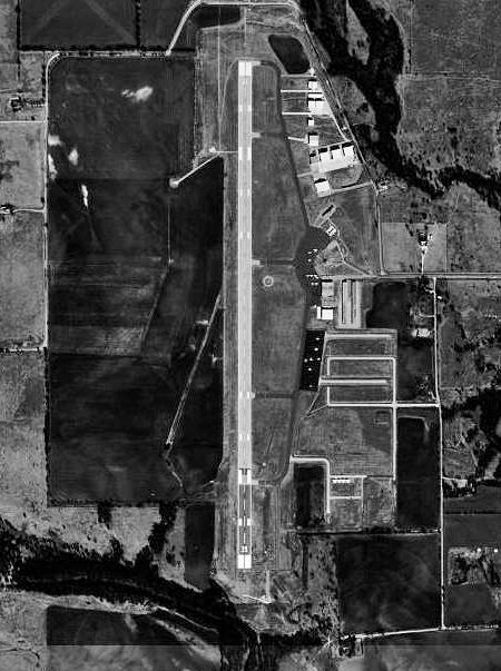
By United States Geological Survey (USGS) - USGS via TopoQuesthttp://www.topoquest.com/map.php?lat=47.03407&lon=-120.53187&datum=nad83&zoom=4&map=sat1m&coord=d&mode=pan&size=m, Public Domain, https://commons.wikimedia.org/w/index.php?curid=19558804 |
Airport Bowers Airport (KELN) |
|
| 6002 |
6181 |
bali |
2018-05-25 20:28:26 |
 |
By United States Department of Agriculture (USDA), Farm Services Agency - National Agriculture Imagery Program (NAIP) Orthoimagery for Zone 16 Alabama State Quarter Quadrangle GREENWOOD, SW and I.D. # n_3308641_sw_16_1_20060818.tif, Public Domain, h |
Airport Bessemer Airport (KEKY) |
|
| 6003 |
6180 |
bali |
2018-05-25 20:28:13 |
 |
By Famartin - Own work, CC BY-SA 4.0, https://commons.wikimedia.org/w/index.php?curid=39768858 |
Airport Elko Regional Airport (KEKO) |
|
| 6004 |
6179 |
bali |
2018-05-25 20:28:05 |
 |
Public Domain, https://en.wikipedia.org/w/index.php?curid=14872456 |
Airport Elkhart Municipal Airport (KEKM) |
|
| 6005 |
6178 |
bali |
2018-05-25 20:27:57 |
 |
By Royalbroil - Own work, CC BY-SA 4.0, https://commons.wikimedia.org/w/index.php?curid=47136197 |
Airport Eagle River Union Airport (KEGV) |
|
| 6006 |
6177 |
bali |
2018-05-25 20:27:49 |
 |
By United States Air Force - http://www.919sow.afrc.af.mil/photos/mediagallery.asp?galleryID=1369&?id=-1&page=1&count=48, Public Domain, https://commons.wikimedia.org/w/index.php?curid=15839241 |
Airport Duke Field (KEGI) |
|
| 6007 |
6176 |
bali |
2018-05-25 20:27:38 |
 |
By David Benbennick - Own workThe second version of the image was cropped losslessly from the first version with the commandjpegtran -crop 2048x640+0+476 Eagle_County_Airport_terminal.jpg > Eagle_County_Airport_terminal.jpg.crop, CC BY-SA 3.0, https |
Airport Eagle County Regional Airport (KEGE) |
|
| 6008 |
6175 |
bali |
2018-05-25 20:27:26 |
 |
By United States Geological Survey (USGS) - USGS The National Map, via MSR Maps (formerly TerraServer-USA)http://msrmaps.com, Public Domain, https://commons.wikimedia.org/w/index.php?curid=3722289 |
Airport Ellington Airport (Texas) (KEFD) |
|
| 6009 |
6174 |
bali |
2018-05-25 20:27:14 |
 |
By United States Department of Agriculture (USDA), Farm Services Agency - National Agriculture Imagery Program (NAIP) Orthoimagery for Zone 16 Alabama State Quarter Quadrangle ALABASTER, SE and I.D. # n_3308650_se_16_1_20060629.tif, Public Domain, h |
Airport Shelby County Airport (Alabama) (KEET) |
|
| 6010 |
6173 |
bali |
2018-05-25 20:27:01 |
 |
By United States Geological Survey (USGS) - USGS via TopoQuesthttp://www.topoquest.com/map.php?lat=34.766389&lon=-114.623333&datum=nad83&zoom=4&map=sat1m, Public Domain, https://commons.wikimedia.org/w/index.php?curid=19869938 |
Airport Needles Airport (KEED) |
|
| 6011 |
6172 |
bali |
2018-05-25 20:26:48 |
 |
By United States Department of Agriculture (USDA), Farm Services Agency - National Agriculture Imagery Program (NAIP) Orthoimagery for Zone 16 Alabama State Quarter Quadrangle ENTERPRISE, SW and I.D. # n_3108542_sw_16_1_20060615.tif, Public Domain, |
Airport Enterprise Municipal Airport (Alabama) (KEDN) |
|
| 6012 |
6171 |
bali |
2018-05-25 20:26:34 |
 |
Public Domain, https://commons.wikimedia.org/w/index.php?curid=1071885 |
Airport Bellefontaine Regional Airport (KEDJ) |
|
| 6013 |
6170 |
bali |
2018-05-25 20:26:26 |
 |
By Larry D. Moore, CC BY-SA 3.0, https://commons.wikimedia.org/w/index.php?curid=20535168 |
Airport Austin Executive Airport (KEDC) |
|
| 6014 |
6169 |
bali |
2018-05-25 20:26:18 |
 |
By United States Geological Survey (USGS) - USGS The National Map, via MSR Maps (formerly TerraServer-USA)http://msrmaps.com/map.aspx?t=1&s=12&lat=40.7255&lon=-99.0068&w=900&h=1000, Public Domain, https://commons.wikimedia.org/w/index.php?curid=3728 |
Airport Kearney Regional Airport (KEAR) |
|
| 6015 |
6168 |
bali |
2018-05-25 20:26:05 |
 |
By United States Department of Agriculture (USDA), Farm Services Agency - National Agriculture Imagery Program (NAIP) Orthoimagery for Zone 16 Alabama State Quarter Quadrangle JEFFERSON, NW and I.D. # n_3208733_nw_16_1_20060818.tif, Public Domain, h |
Airport Demopolis Municipal Airport (KDYA) |
|
| 6016 |
6167 |
bali |
2018-05-25 20:25:52 |
 |
By AirportExpert - Own work, CC BY-SA 4.0, https://commons.wikimedia.org/w/index.php?curid=66431395 |
Airport Danbury Municipal Airport (KDXR) |
|
| 6017 |
6166 |
bali |
2018-05-25 20:25:43 |
 |
By United States Geological Survey (USGS) - USGS via TopoQuesthttp://www.topoquest.com/map.php?lat=38.579444&lon=-121.856944&datum=nad83&zoom=4&map=sat1m, Public Domain, https://commons.wikimedia.org/w/index.php?curid=19884093 |
Airport Yolo County Airport (KDWA) |
|
| 6018 |
6165 |
bali |
2018-05-25 20:25:31 |
 |
By USAAF - U.S. Air Force photo 090821-F-1234S-001 from the National Museum of the USAF , Public Domain, https://commons.wikimedia.org/w/index.php?curid=8692765 |
Airport Bisbee Douglas International Airport (KDUG) |
|
| 6019 |
6164 |
bali |
2018-05-25 20:25:21 |
 |
By United States Geological Survey (USGS) - USGS The National Map, via MSR Maps (formerly TerraServer-USA)http://msrmaps.com/map.aspx?t=1&s=12&lon=-97.198056&lat=33.200833&w=1000&h=800, Public Domain, https://commons.wikimedia.org/w/index.php?curid= |
Airport Denton Municipal Airport (KDTO) |
|
| 6020 |
6163 |
bali |
2018-05-25 20:25:08 |
 |
By United States Geological Survey (USGS) - USGS via TopoQuesthttp://www.topoquest.com/map.php?lat=30.83167&lon=-93.34000&datum=nad83&zoom=4&map=sat1m&coord=d&mode=zoomin&size=l, Public Domain, https://commons.wikimedia.org/w/index.php?curid=1951893 |
Airport Beauregard Regional Airport (KDRI) |
|
| 6021 |
6162 |
bali |
2018-05-25 20:24:55 |
 |
By US Geological Survey - http://www.topoquest.com/map.php?lat=31.476667&lon=-82.860556&datum=nad83&zoom=4&map=sat1m, Public Domain, https://commons.wikimedia.org/w/index.php?curid=20291225 |
Airport Douglas Municipal Airport (Georgia) (KDQH) |
|
| 6022 |
6161 |
bali |
2018-05-25 20:24:44 |
 |
By United States Geological Survey (USGS) - USGS via TopoQuesthttp://www.topoquest.com/map.php?lat=40.19662&lon=-112.93578&datum=nad83&zoom=8&map=sat1m&coord=d&mode=zoomout&size=l, Public Domain, https://commons.wikimedia.org/w/index.php?curid=17283 |
Airport Michael Army Airfield (KDPG) |
|
| 6023 |
6160 |
bali |
2018-05-25 20:24:32 |
 |
By United States Air Force - http://www.dover.af.mil/photos/mediagallery.asp?galleryID=1384, Public Domain, https://commons.wikimedia.org/w/index.php?curid=15808745 |
Airport Dover AFB (KDOV) |
|
| 6024 |
6159 |
bali |
2018-05-25 20:24:21 |
 |
By US Geological Survey - http://www.topoquest.com/map.php?lat=33.466389&lon=-82.039444&datum=nad83&zoom=4&map=sat1m, Public Domain, https://commons.wikimedia.org/w/index.php?curid=20295621 |
Airport Daniel Field (KDNL) |
|
| 6025 |
6158 |
bali |
2018-05-25 20:24:11 |
 |
By United States Geological Survey (USGS) - USGS via TopoQuesthttp://www.topoquest.com/map.php?lat=32.25597&lon=-107.71901&datum=nad83&zoom=4&map=sat1m&coord=d&mode=pan&size=l, Public Domain, https://commons.wikimedia.org/w/index.php?curid=19679841 |
Airport Deming Municipal Airport (KDMN) |
|
|
|
|
|
|
|
|
|
| # |
ID
|
Uploaded by
|
Uploaded on
|
Picture
|
Description
|
Related item(s)
|
|