Pictures
| # |
ID


|
Uploaded by
|
Uploaded on

|
Picture
|
Description
|
Related item(s)
|


|
| 6051 |
6132 |
 bali |
2018-05-25 20:19:27 |
 |
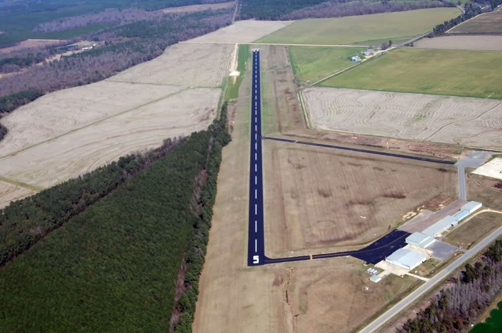
By Don Ramey Logan - Own work, CC BY 4.0, https://commons.wikimedia.org/w/index.php?curid=39254193 |
Airport Hollister Municipal Airport (KCVH) |
|
| 6052 |
6131 |
bali |
2018-05-25 20:19:18 |
 |
By United States Geological Survey (USGS) - USGS via TopoQuesthttp://topoquest.com/map.php?lat=33.970556&lon=-80.995278&datum=nad83&zoom=4&map=sat1m, Public Domain, https://commons.wikimedia.org/w/index.php?curid=20327836 |
Airport Jim Hamilton-L.B. Owens Airport (KCUB) |
|
| 6053 |
6130 |
bali |
2018-05-25 20:19:06 |
 |
By United States Geological Survey (USGS) - USGS The National Map, via MSR Maps (formerly TerraServer-USA)Interactive map: http://msrmaps.com/map.aspx?t=1&s=12&lat=29.6355&lon=-83.1047&w=650&h=650Image: http://msrmaps.com/GetImageArea.ashx?t=1&s=11& |
Airport Cross City Airport (KCTY) |
|
| 6054 |
6129 |
bali |
2018-05-25 20:18:52 |
 |
By United States Geological Survey (USGS) - USGS via TopoQuesthttp://www.topoquest.com/map.php?lat=48.61284&lon=-112.38654&datum=nad83&zoom=8&map=sat1m&coord=d&mode=zoomin&size=l, Public Domain, https://commons.wikimedia.org/w/index.php?curid=195253 |
Airport Cut Bank Municipal Airport (KCTB) |
|
| 6055 |
6128 |
bali |
2018-05-25 20:18:40 |
 |
By Civil Air Patrol - Arkansas Department of Aeronautics, Public Domain, https://commons.wikimedia.org/w/index.php?curid=39887595 |
Airport Z. M. Jack Stell Field (KCRT) |
|
| 6056 |
6127 |
bali |
2018-05-25 20:18:31 |
 |
By United States Geological Survey (USGS) - USGS via TopoQuesthttp://www.topoquest.com/map.php?lat=32.028056&lon=-96.400556&datum=nad83&zoom=4&map=sat1m, Public Domain, https://commons.wikimedia.org/w/index.php?curid=19542580 |
Airport C. David Campbell Field (KCRS) |
|
| 6057 |
6126 |
bali |
2018-05-25 20:18:18 |
 |
By United States Geological Survey (USGS) - USGS via TopoQuesthttp://www.topoquest.com/map.php?lat=36.10291&lon=-119.59522&datum=nad83&zoom=2&map=sat1m&coord=d&mode=zoomin&size=l, Public Domain, https://commons.wikimedia.org/w/index.php?curid=198635 |
Airport Corcoran Airport (KCRO) |
|
| 6058 |
6125 |
bali |
2018-05-25 20:18:06 |
 |
By United States Geological Survey (USGS) - USGS via TopoQuesthttp://topoquest.com/map.php?lat=33.80947&lon=-78.72200&datum=nad83&zoom=4&map=sat1m&coord=d&mode=pan&size=m, Public Domain, https://commons.wikimedia.org/w/index.php?curid=20318041 |
Airport Grand Strand Airport (KCRE) |
|
| 6059 |
6124 |
bali |
2018-05-25 20:17:53 |
 |
By United States Department of Agriculture (USDA), Farm Services Agency - National Agriculture Imagery Program (NAIP) Orthoimagery for Zone 16 Alabama State Quarter Quadrangle POINT CLEAR, NE and I.D. # n_3008733_ne_16_1_20060630.tif, Public Domain, |
Airport H. L. Sonny Callahan Airport (KCQF) |
|
| 6060 |
6123 |
bali |
2018-05-25 20:17:40 |
 |
By United States Geological Survey (USGS) - USGS via TopoQuesthttp://www.topoquest.com/map.php?lat=42.90660&lon=-106.46602&datum=nad83&zoom=8&map=sat1m&coord=d&mode=zoomout&size=l, Public Domain, https://commons.wikimedia.org/w/index.php?curid=19593 |
Airport Casper-Natrona County International Airport (KCPR) |
|
| 6061 |
6122 |
bali |
2018-05-25 20:17:27 |
 |
By John Kahrs - personally created, Public Domain, https://commons.wikimedia.org/w/index.php?curid=28642060 |
Airport Compton/Woodley Airport (KCPM) |
|
| 6062 |
6121 |
bali |
2018-05-25 20:17:18 |
 |
CC BY-SA 3.0, https://en.wikipedia.org/w/index.php?curid=13270787 |
Airport Columbia Regional Airport (KCOU) |
|
| 6063 |
6120 |
bali |
2018-05-25 20:17:11 |
 |
By SayCheeeeeese - Own work, Public Domain, https://commons.wikimedia.org/w/index.php?curid=2865376 |
Airport Concord Municipal Airport (KCON) |
|
| 6064 |
6119 |
bali |
2018-05-25 20:17:02 |
 |
By United States Geological Survey (USGS) - USGS The National Map, via MSR Maps (formerly TerraServer-USA)http://msrmaps.com/map.aspx?t=1&s=11&lon=-99.403333&lat=31.841111&w=800&h=800, Public Domain, https://commons.wikimedia.org/w/index.php?curid=9 |
Airport Coleman Municipal Airport (KCOM) |
|
| 6065 |
6118 |
bali |
2018-05-25 20:16:48 |
 |
By U.S. Air Force/Carleton Bailie - http://www.af.mil/News/Photos.aspx?igphoto=2000597556 (image link), Public Domain, https://commons.wikimedia.org/w/index.php?curid=72770 |
Airport Patrick Air Force Base (KCOF) |
|
| 6066 |
6117 |
bali |
2018-05-25 20:16:38 |
 |
By United States Geological Survey (USGS) - USGS via TopoQuesthttp://www.topoquest.com/map.php?lat=31.63729&lon=-97.07833&datum=nad83&zoom=4&map=sat1m&coord=d&mode=pan&size=l, Public Domain, https://commons.wikimedia.org/w/index.php?curid=19545404 |
Airport TSTC Waco Airport (KCNW) |
|
| 6067 |
6116 |
bali |
2018-05-25 20:16:25 |
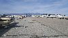 |
By Don Ramey Logan - Own work, CC BY-SA 4.0, https://commons.wikimedia.org/w/index.php?curid=56794448 |
Airport Chino Airport (KCNO) |
|
| 6068 |
6115 |
bali |
2018-05-25 20:16:16 |
 |
By United States Geological Survey (USGS) - USGS via TopoQuesthttp://www.topoquest.com/map.php?lat=32.33155&lon=-104.26427&datum=nad83&zoom=4&map=sat1m&coord=d&mode=pan&size=l, Public Domain, https://commons.wikimedia.org/w/index.php?curid=19662961 |
Airport Cavern City Air Terminal (KCNM) |
|
| 6069 |
6114 |
bali |
2018-05-25 20:16:03 |
 |
By Thomson200 - Own work, CC0, https://commons.wikimedia.org/w/index.php?curid=56639960 |
Airport Cherokee County Airport (Georgia) (KCNI) |
|
| 6070 |
6113 |
bali |
2018-05-25 20:15:55 |
 |
By FAA - http://www.ama500.jccbi.gov/cmiatct/airports.htm via en:Image:Kcmi.jpg, Public Domain, https://commons.wikimedia.org/w/index.php?curid=2181476 |
Airport University of Illinois Willard Airport (KCMI) |
|
| 6071 |
6112 |
bali |
2018-05-25 20:15:45 |
 |
By United States Department of Agriculture (USDA), Farm Services Agency - National Agriculture Imagery Program (NAIP) Orthoimagery for Zone 16 Alabama State Quarter Quadrangle FALKVILLE, SE and I.D. # n_3408641_se_16_1_20060824.tif, Public Domain, h |
Airport Folsom Field (Alabama) (KCMD) |
|
| 6072 |
6111 |
bali |
2018-05-25 20:15:32 |
 |
By United States Geological Survey (USGS) - USGS via TopoQuesthttp://www.topoquest.com/map.php?lat=34.21374&lon=-119.08853&datum=nad83&zoom=4&map=sat1m&coord=d&mode=pan&size=l, Public Domain, https://commons.wikimedia.org/w/index.php?curid=17278839 |
Airport Camarillo Airport (KCMA) |
|
| 6073 |
6110 |
bali |
2018-05-25 20:15:19 |
 |
By United States Geological Survey (USGS) - USGS via TopoQuesthttp://www.topoquest.com/map.php?lat=48.12028&lon=-123.49972&datum=nad83&zoom=4&map=sat1m&coord=d&mode=zoomin&size=l, Public Domain, https://commons.wikimedia.org/w/index.php?curid=195579 |
Airport William R. Fairchild International Airport (KCLM) |
|
| 6074 |
6109 |
bali |
2018-05-25 20:15:06 |
 |
By unknown US Federal employee - see above, Public Domain, https://commons.wikimedia.org/w/index.php?curid=3726314 |
Airport Easterwood Airport (KCLL) |
|
| 6075 |
6108 |
bali |
2018-05-25 20:14:54 |
 |
By self - Own work, CC BY-SA 2.5, https://commons.wikimedia.org/w/index.php?curid=3783704 |
Airport Clintonville Municipal Airport (KCLI) |
|
|
|
|
|
|
|
|
|
| # |
ID
|
Uploaded by
|
Uploaded on
|
Picture
|
Description
|
Related item(s)
|
|