Pictures
| # |
ID


|
Uploaded by
|
Uploaded on

|
Picture
|
Description
|
Related item(s)
|


|
| 6076 |
6107 |
 bali |
2018-05-25 20:14:46 |
 |
By United States Geological Survey (USGS) - USGS The National Map, via MSR Maps (formerly TerraServer-USA)http://msrmaps.com/map.aspx?t=1&s=12&lon=-87.414953&lat=36.621881&w=600&h=800, Public Domain, https://commons.wikimedia.org/w/index.php?curid=9 |
Airport Clarksville-Montgomery County Regional Airport (KCKV) |
|
| 6077 |
6106 |
bali |
2018-05-25 20:14:33 |
 |
By Mikemsr17 - Own work, CC BY-SA 4.0, https://commons.wikimedia.org/w/index.php?curid=66112865 |
Airport Crookston Municipal Airport (KCKN) |
|
| 6078 |
6105 |
bali |
2018-05-25 20:14:24 |
 |
By United States Geological Survey (USGS) - USGS via TopoQuesthttp://www.topoquest.com/map.php?lat=34.299722&lon=-90.512222&datum=nad83&zoom=4&map=sat1m, Public Domain, https://commons.wikimedia.org/w/index.php?curid=20068900 |
Airport Fletcher Field (KCKM) |
|
| 6079 |
6104 |
bali |
2018-05-25 20:14:12 |
 |
By US Geological Survey - http://www.topoquest.com/map.php?lat=31.988889&lon=-83.773889&datum=nad83&zoom=4&map=sat1m, Public Domain, https://commons.wikimedia.org/w/index.php?curid=20290486 |
Airport Crisp County-Cordele Airport (KCKF) |
|
| 6080 |
6103 |
bali |
2018-05-25 20:14:01 |
 |
By Calebrw - Own work, CC BY-SA 3.0, https://commons.wikimedia.org/w/index.php?curid=7253664 |
Airport Grand Marais/Cook County Airport (KCKC) |
|
| 6081 |
6102 |
bali |
2018-05-25 20:13:53 |
 |
By United States Geological Survey (USGS) - USGS The National Map, via MSR Maps: Image, Interactive map, Public Domain, https://commons.wikimedia.org/w/index.php?curid=17098774 |
Airport North Central West Virginia Airport (KCKB) |
|
| 6082 |
6101 |
bali |
2018-05-25 20:13:42 |
 |
By redlegsfan21 from Vandalia, OH, United States - Culpeper Regional Airport, CC BY-SA 2.0, https://commons.wikimedia.org/w/index.php?curid=24452818 |
Airport Culpeper Regional Airport (KCJR) |
|
| 6083 |
6100 |
bali |
2018-05-25 20:13:31 |
 |
By United States Geological Survey (USGS) - USGS via TopoQuesthttp://www.topoquest.com/map.php?lat=46.25068&lon=-84.46882&datum=nad83&zoom=8&map=sat1m&coord=d&mode=zoomin&size=l, Public Domain, https://commons.wikimedia.org/w/index.php?curid=1729347 |
Airport Chippewa County International Airport (KCIU) |
|
| 6084 |
6099 |
bali |
2018-05-25 20:13:18 |
 |
By United States Geological Survey (USGS) - USGS via TopoQuesthttp://www.topoquest.com/map.php?lat=39.79528&lon=-121.85833&datum=nad83&zoom=4&map=sat1m&coord=d&mode=zoomin&size=l, Public Domain, https://commons.wikimedia.org/w/index.php?curid=172169 |
Airport Chico Municipal Airport (KCIC) |
|
| 6085 |
6098 |
bali |
2018-05-25 20:13:05 |
 |
By United States Geological Survey (USGS) - USGS The National Map, via MSR Maps (formerly TerraServer-USA)http://msrmaps.com/map.aspx?t=1&s=12&lon=-97.9675&lat=35.097222&w=600&h=400, Public Domain, https://commons.wikimedia.org/w/index.php?curid=956 |
Airport Chickasha Municipal Airport (KCHK) |
|
| 6086 |
6097 |
bali |
2018-05-25 20:12:53 |
 |
By United States Geological Survey (USGS) - USGS via TopoQuesthttp://www.topoquest.com/map.php?lat=37.22528&lon=-89.57083&datum=nad83&zoom=4&map=sat1m&coord=d&mode=zoomin&size=l, Public Domain, https://commons.wikimedia.org/w/index.php?curid=1966487 |
Airport Cape Girardeau Regional Airport (KCGI) |
|
| 6087 |
6096 |
bali |
2018-05-25 20:12:40 |
 |
By United States Geological Survey (USGS) - USGS via GPSvisualizer.comhttp://www.gpsvisualizer.com/map_input?special=wikipedia&format=google&bg_map=usgs_aerial&sp_width=50km&form:data=type,name,latitude,longitude%0DW,%22Coffeyville%20Municipal%20Air |
Airport Coffeyville Municipal Airport (KCFV) |
|
| 6088 |
6095 |
bali |
2018-05-25 20:12:27 |
 |
By Gomez2k02 (talk) (Uploads) - Own work, Public Domain, https://en.wikipedia.org/w/index.php?curid=27396079 |
Airport Essex County Airport (KCDW) |
|
| 6089 |
6094 |
bali |
2018-05-25 20:12:18 |
 |
By United States Geological Survey (USGS) - USGS via TopoQuesthttp://www.topoquest.com/map.php?lat=34.43378&lon=-100.28799&datum=nad83&zoom=4&map=sat1m&coord=d&mode=zoomin&size=l, Public Domain, https://commons.wikimedia.org/w/index.php?curid=195425 |
Airport Childress Municipal Airport (KCDS) |
|
| 6090 |
6093 |
bali |
2018-05-25 20:12:05 |
 |
By United States Geological Survey (USGS) - USGS via TopoQuesthttp://www.topoquest.com/map.php?lat=34.28361&lon=-80.56500&datum=nad83&zoom=4&map=sat1m&coord=d&mode=zoomin&size=l, Public Domain, https://commons.wikimedia.org/w/index.php?curid=1951185 |
Airport Woodward Field (airport) (KCDN) |
|
| 6091 |
6092 |
bali |
2018-05-25 20:11:53 |
 |
By Civil Air Patrol - Arkansas Department of Aeronautics, Public Domain, https://commons.wikimedia.org/w/index.php?curid=31083454 |
Airport Harrell Field (KCDH) |
|
| 6092 |
6091 |
bali |
2018-05-25 20:11:43 |
 |
By United States Geological Survey (USGS) - Also available via MSR Maps, Public Domain, https://commons.wikimedia.org/w/index.php?curid=17214761 |
Airport Buchanan Field Airport (KCCR) |
|
| 6093 |
6090 |
bali |
2018-05-25 20:11:33 |
 |
By Civil Air Patrol - Arkansas Department of Aeronautics, Public Domain, https://commons.wikimedia.org/w/index.php?curid=39887574 |
Airport Clinton Municipal Airport (Arkansas) (KCCA) |
|
| 6094 |
6089 |
bali |
2018-05-25 20:11:24 |
 |
By United States Air Force - http://www.columbus.af.mil/shared/media/photodb/photos/090526-F-0000C-063.jpg, Public Domain, https://commons.wikimedia.org/w/index.php?curid=6997673 |
Airport Columbus AFB (KCBM) |
|
| 6095 |
6088 |
bali |
2018-05-25 20:11:14 |
 |
By Civil Air Patrol - Arkansas Department of Aeronautics, Public Domain, https://commons.wikimedia.org/w/index.php?curid=31083142 |
Airport Arkansas International Airport (KBYH) |
|
| 6096 |
6087 |
bali |
2018-05-25 20:11:05 |
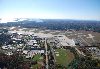 |
By Mass Communications Specialist 2nd Class David Hewitt - U.S. Navy Naval Air Station Brunswick website, retrieved 2009-02-27 , Public Domain, https://commons.wikimedia.org/w/index.php?curid=6056440 |
Airport Brunswick Executive Airport (KBXM) |
|
| 6097 |
6086 |
bali |
2018-05-25 20:10:54 |
 |
By Marine 69-71 - Own work, CC BY-SA 4.0, https://commons.wikimedia.org/w/index.php?curid=59843540 |
Airport Buckeye Municipal Airport (KBXK) |
|
| 6098 |
6085 |
bali |
2018-05-25 20:10:45 |
 |
By James G. Howes, Attribution, https://commons.wikimedia.org/w/index.php?curid=6945193 |
Airport Baltimore-Washington International Airport (KBWI) |
|
| 6099 |
6084 |
bali |
2018-05-25 20:10:37 |
 |
By GoHawks20152016 - Own work, CC BY 4.0, https://commons.wikimedia.org/w/index.php?curid=50435885 |
Airport Bowling Green-Warren County Regional Airport (KBWG) |
|
| 6100 |
6083 |
bali |
2018-05-25 20:10:28 |
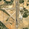 |
By United States Geological Survey (USGS) - USGS via TopoQuesthttp://www.topoquest.com/map.php?lat=31.793622&lon=-98.956495&datum=nad83&zoom=4&map=sat1m, Public Domain, https://commons.wikimedia.org/w/index.php?curid=19547411 |
Airport Brownwood Regional Airport (KBWD) |
|
|
|
|
|
|
|
|
|
| # |
ID
|
Uploaded by
|
Uploaded on
|
Picture
|
Description
|
Related item(s)
|
|


