Pictures
| # |
ID


|
Uploaded by
|
Uploaded on

|
Picture
|
Description
|
Related item(s)
|


|
| 6101 |
6082 |
 bali |
2018-05-25 20:10:16 |
 |
By Civil Air Patrol - Arkansas Department of Aeronautics, Public Domain, https://commons.wikimedia.org/w/index.php?curid=30825619 |
Airport Batesville Regional Airport (KBVX) |
|
| 6102 |
6081 |
bali |
2018-05-25 20:10:07 |
 |
By Konstantin von Wedelstaedt - Gallery page http://www.airliners.net/photo//1977832/LPhoto http://cdn-www.airliners.net/aviation-photos/photos/2/3/8/1977832.jpg, GFDL 1.2, https://commons.wikimedia.org/w/index.php?curid=26812117 |
Airport Boulder City Municipal Airport (KBVU) |
|
| 6103 |
6080 |
bali |
2018-05-25 20:09:55 |
 |
By Joe Kunzler from Sedro-Woolley, United States of America - Panorama from the Kitty Hawk Cafe, CC BY-SA 2.0, https://commons.wikimedia.org/w/index.php?curid=34807634 |
Airport Skagit Regional Airport (KBVS) |
|
| 6104 |
6079 |
bali |
2018-05-25 20:09:45 |
 |
By Eric Salard - BVO BARTLESVILLE MUNICIPAL AIRPORT FLIGHT CDG-IAH 777 F-GSQM, CC BY-SA 2.0, https://commons.wikimedia.org/w/index.php?curid=29388779 |
Airport Bartlesville Municipal Airport (KBVO) |
|
| 6105 |
6078 |
bali |
2018-05-25 20:09:34 |
 |
By DanRother (talk) - I (DanRother (talk)) created this work entirely by myself., Public Domain, https://en.wikipedia.org/w/index.php?curid=23912228 |
Airport Buffalo Niagara International Airport (KBUF) |
|
| 6106 |
6077 |
bali |
2018-05-25 20:09:25 |
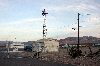 |
By Finetooth - Own work, CC BY-SA 3.0, https://commons.wikimedia.org/w/index.php?curid=6269796 |
Airport Beatty Airport (KBTY) |
|
| 6107 |
6076 |
bali |
2018-05-25 20:09:16 |
 |
By TLSuda - Own work, CC BY-SA 4.0, https://commons.wikimedia.org/w/index.php?curid=55068644 |
Airport Baton Rouge Metropolitan Airport (KBTR) |
|
| 6108 |
6075 |
bali |
2018-05-25 20:09:08 |
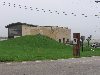 |
By Original uploader was Mvincec at en.wikipedia - Transferred from en.wikipedia to Commons., Public Domain, https://commons.wikimedia.org/w/index.php?curid=3560040 |
Airport Butler County Airport (KBTP) |
|
| 6109 |
6074 |
bali |
2018-05-25 20:08:58 |
 |
By United States Geological Survey (USGS) - USGS The National Map, via MSR Maps (formerly TerraServer-USA)http://msrmaps.com, Public Domain, https://commons.wikimedia.org/w/index.php?curid=3726255 |
Airport Brownsville/South Padre Island International Airport (KBRO) |
|
| 6110 |
6073 |
bali |
2018-05-25 20:08:46 |
 |
By US Geological Survey - http://www.topoquest.com/map.php?lat=27.943333&lon=-81.783333&datum=nad83&zoom=4&map=sat1m, Public Domain, https://commons.wikimedia.org/w/index.php?curid=20452879 |
Airport Bartow Municipal Airport (KBOW) |
|
| 6111 |
6072 |
bali |
2018-05-25 20:08:36 |
 |
By Richard Bauer - Burns Airport, CC BY 2.0, https://commons.wikimedia.org/w/index.php?curid=60137258 |
Airport Burns Municipal Airport (KBNO) |
|
| 6112 |
6071 |
bali |
2018-05-25 20:08:27 |
 |
By United States Geological Survey (USGS) - USGS via TopoQuesthttp://www.topoquest.com/map.php?lat=33.25778&lon=-81.38833&datum=nad83&zoom=4&map=sat1m&coord=d&mode=zoomin&size=l, Public Domain, https://commons.wikimedia.org/w/index.php?curid=1951197 |
Airport Barnwell Regional Airport (KBNL) |
|
| 6113 |
6070 |
bali |
2018-05-25 20:08:14 |
 |
Public Domain, https://en.wikipedia.org/w/index.php?curid=4650624 |
Airport Monroe County Airport (Indiana) (KBMG) |
|
| 6114 |
6069 |
bali |
2018-05-25 20:08:07 |
 |
By United States Geological Survey (USGS) - USGS The National Map, via MSR Maps (formerly TerraServer-USA)http://msrmaps.com/image.aspx?T=1&S=13&Z=16&X=157&Y=2668&W=3&qs=%7cScott+AFB%7cIL%7c, Public Domain, https://commons.wikimedia.org/w/index.php? |
Airport MidAmerica St. Louis Airport (KBLV) |
|
| 6115 |
6068 |
bali |
2018-05-25 20:07:53 |
 |
By TomLozeThwaite - Own work, CC BY 3.0, https://commons.wikimedia.org/w/index.php?curid=4526488 |
Airport Blythe Airport (KBLH) |
|
| 6116 |
6067 |
bali |
2018-05-25 20:07:44 |
 |
By US Geological Survey - http://www.topoquest.com/map.php?lat=28.47338&lon=-82.45597&datum=nad83&zoom=4&map=sat1m&coord=d&mode=pan&size=l, Public Domain, https://commons.wikimedia.org/w/index.php?curid=20407671 |
Airport Brooksville-Tampa Bay Regional Airport (KBKV) |
|
| 6117 |
6066 |
bali |
2018-05-25 20:07:32 |
 |
By Idawriter, CC BY-SA 3.0, https://commons.wikimedia.org/w/index.php?curid=53241038 |
Airport Blackstone Army Airfield (KBKT) |
|
| 6118 |
6065 |
bali |
2018-05-25 20:07:24 |
 |
By aeroplanepics0112 - Own work, CC BY-SA 3.0, https://commons.wikimedia.org/w/index.php?curid=17853056 |
Airport Cleveland Burke Lakefront Airport (KBKL) |
|
| 6119 |
6064 |
bali |
2018-05-25 20:07:15 |
 |
By Nefoley26 - Own work, CC BY-SA 4.0, https://commons.wikimedia.org/w/index.php?curid=52220366 |
Airport Keesler AFB (KBIX) |
|
| 6120 |
6063 |
bali |
2018-05-25 20:07:06 |
 |
By United States Geological Survey (USGS) - USGS via TopoQuesthttp://www.topoquest.com/map.php?lat=37.37306&lon=-118.36361&datum=nad83&zoom=4&map=sat1m&coord=d&mode=zoomin&size=l, Public Domain, https://commons.wikimedia.org/w/index.php?curid=172145 |
Airport Eastern Sierra Regional Airport (KBIH) |
|
| 6121 |
6062 |
bali |
2018-05-25 20:06:53 |
 |
By United States Geological Survey (USGS) - USGS The National Map, via MSR Maps (formerly TerraServer-USA)1996 image: http://msrmaps.com/map.aspx?t=1&s=13&lat=31.8315&lon=-106.3825&w=800&h=10002002 image: http://msrmaps.com/map.aspx?t=4&s=13&lat=31. |
Airport Biggs Army Airfield (KBIF) |
|
| 6122 |
6061 |
bali |
2018-05-25 20:06:40 |
 |
By Beatrice Murch - originally posted to Flickr as Beatrice Municipal Airport, CC BY 2.0, https://commons.wikimedia.org/w/index.php?curid=6801228 |
Airport Beatrice Municipal Airport (KBIE) |
|
| 6123 |
6060 |
bali |
2018-05-25 20:06:31 |
 |
By Timothy J. Quill - Timothy J. Quill, CC BY 3.0, https://commons.wikimedia.org/w/index.php?curid=41893301 |
Airport Block Island State Airport (KBID) |
|
| 6124 |
6059 |
bali |
2018-05-25 20:06:21 |
 |
By United States Geological Survey (USGS) - USGS via TopoQuesthttp://www.topoquest.com/map.php?lat=30.97266&lon=-84.63044&datum=nad83&zoom=4&map=sat1m&coord=d&mode=pan&size=l, Public Domain, https://commons.wikimedia.org/w/index.php?curid=17412186 |
Airport Decatur County Industrial Air Park (KBGE) |
|
| 6125 |
6058 |
bali |
2018-05-25 20:06:08 |
 |
By United States Geological Survey (USGS) - USGS The National Map, via MSR Maps (formerly TerraServer-USA), Public Domain, https://commons.wikimedia.org/w/index.php?curid=3883036 |
Airport Mobile Downtown Airport (KBFM) |
|
|
|
|
|
|
|
|
|
| # |
ID
|
Uploaded by
|
Uploaded on
|
Picture
|
Description
|
Related item(s)
|
|


