Pictures
| # |
ID


|
Uploaded by
|
Uploaded on

|
Picture
|
Description
|
Related item(s)
|


|
| 6126 |
6057 |
 bali |
2018-05-25 20:05:58 |
 |
By United States Geological Survey (USGS) - USGS via TopoQuesthttp://www.topoquest.com/map.php?lat=35.43444&lon=-119.05881&datum=nad83&zoom=8&map=sat1m&coord=d&mode=zoomout&size=l, Public Domain, https://commons.wikimedia.org/w/index.php?curid=19861 |
Airport Meadows Field Airport (KBFL) |
|
| 6127 |
6056 |
bali |
2018-05-25 20:05:44 |
 |
By United States Geological Survey (USGS) - USGS via TopoQuesthttp://www.topoquest.com/map.php?lat=47.53000&lon=-122.30194&datum=nad83&zoom=4&map=sat1m&coord=d&mode=zoomin&size=l, Public Domain, https://commons.wikimedia.org/w/index.php?curid=195583 |
Airport Boeing Field (KBFI) |
|
| 6128 |
6055 |
bali |
2018-05-25 20:05:31 |
 |
By United States Geological Survey (USGS) - USGS The National Map, via MSR Maps (formerly TerraServer-USA)Interactive map: http://msrmaps.com/map.aspx?t=1&s=12&lat=42.4699&lon=-71.289&w=900&h=700Image: http://msrmaps.com/GetImageArea.ashx?t=1&s=11&l |
Airport Hanscom Field (KBED) |
|
| 6129 |
6054 |
bali |
2018-05-25 20:05:18 |
 |
By Gabeguss - Own work, CC BY-SA 3.0, https://commons.wikimedia.org/w/index.php?curid=11138171 |
Airport Bend Municipal Airport (KBDN) |
|
| 6130 |
6053 |
bali |
2018-05-25 20:05:10 |
 |
By Bobak Ha'Eri - Own work, CC BY 3.0, https://commons.wikimedia.org/w/index.php?curid=25257509 |
Airport Willmar Municipal Airport (KBDH) |
|
| 6131 |
6052 |
bali |
2018-05-25 20:05:01 |
 |
By Smash the Iron Cage - Own work, CC BY-SA 4.0, https://commons.wikimedia.org/w/index.php?curid=39888428 |
Airport Virginia Tech Montgomery Executive Airport (KBCB) |
|
| 6132 |
6051 |
bali |
2018-05-25 20:04:52 |
 |
By United States Geological Survey (USGS) - USGS via TopoQuesthttp://topoquest.com/map.php?lat=34.621667&lon=-79.734444&datum=nad83&zoom=4&map=sat1m, Public Domain, https://commons.wikimedia.org/w/index.php?curid=20320063 |
Airport Marlboro County Jetport (KBBP) |
|
| 6133 |
6050 |
bali |
2018-05-25 20:04:40 |
 |
By United States Geological Survey (USGS) - USGS The National Map, via MSR Maps (formerly TerraServ168342&w=800&h=800, Public Domain, https://commons.wikimedia.org/w/index.php?curid=9 |
Airport Curtis Field (KBBD) |
|
| 6134 |
6049 |
bali |
2018-05-25 20:04:26 |
 |
By Larry D. Moore, CC BY-SA 3.0, https://commons.wikimedia.org/w/index.php?curid=25453501 |
Airport New Braunfels Regional Airport (KBAZ) |
|
| 6135 |
6048 |
bali |
2018-05-25 20:04:18 |
 |
By USGS - USGS, Public Domain, https://commons.wikimedia.org/w/index.php?curid=3728193 |
Airport Columbus Municipal Airport (Indiana) (KBAK) |
|
| 6136 |
6047 |
bali |
2018-05-25 20:04:09 |
 |
By United States Geological SPublic Domain, https://commons.wikim |
Airport Waycross-Ware County Airport (KAYS) |
|
| 6137 |
6046 |
bali |
2018-05-25 20:03:56 |
 |
By Doodybutch - Own work, CC BY-SA 4.0, https://commons.wikimedia.org/w/index.php?curid=59192984 |
Airport Moore Army Airfield (KAYE) |
|
| 6138 |
6045 |
bali |
2018-05-25 20:03:47 |
 |
By NASA/JPL/NIMAThis image uses high-resolution digital topography data from NASA's Shuttle Radar Topography Mission (SRTM) at JPL-Caltech . It is in the public domain in the United States. |
Airport Catalina Airport (KAVX) |
|
| 6139 |
6044 |
bali |
2018-05-25 19:46:59 |
 |
By United States Geological Survey - USGS via TopoQuest - https://www.topoquest.com/map.php?lat=32.40900&lon=-111.21631&datum=nad83&zoom=4&map=sat1m&coord=d&mode=zoomin&size=m, Public Domain, https://commons.wikimedia.org/w/index.php?curid=67415868 |
Airport Marana Regional Airport (KAVQ) |
|
| 6140 |
6043 |
bali |
2018-05-25 19:46:46 |
 |
By US Geological Survey - http://www.topoquest.com/map.php?lat=27.591389&lon=-81.528889&datum=nad83&zoom=4&map=sat1m, Public Domain, https://commons.wikimedia.org/w/index.php?curid=20598213 |
Airport Avon Park Executive Airport (KAVO) |
|
| 6141 |
6042 |
bali |
2018-05-25 19:46:35 |
 |
By United States Department of Agriculture (USDA), Farm Services Agency - National Agriculture Imagery Program (NAIP) Orthoimagery for Zone 16 Alabama State Quarter Quadrangle OPELIKA WEST, SW and I.D. # n_3208521_sw_16_1_20060630.tif, Public Domain |
Airport Auburn University Regional Airport (KAUO) |
|
| 6142 |
6041 |
bali |
2018-05-25 19:46:22 |
 |
By United States Geological Survey (USGS) - USGS The National Map, via MSR Maps (formerly TerraServer-USA)http://msrmaps.com/map.aspx?t=1&s=12&lon=-104.4675&lat=32.8525&w=800&h=800, Public Domain, https://commons.wikimedia.org/w/index.php?curid=9634 |
Airport Artesia Municipal Airport (KATS) |
|
| 6143 |
6040 |
bali |
2018-05-25 19:46:08 |
 |
By United States Department of Agriculture (USDA), Farm Services Agency - National Agriculture Imagery Program (NAIP) Orthoimagery for Zone 16 Alabama State Quarter Quadrangle EASTABOGA, NW and I.D. # n_3308632_nw_16_1_20060621.tif, Public Domain, h |
Airport Talladega Municipal Airport (KASN) |
|
| 6144 |
6039 |
bali |
2018-05-25 19:45:55 |
 |
By United States Geological Survey (USGS) - USGS via GPS Visualizer websitehttp://www.gpsvisualizer.com/map_input?special=wikipedia&format=google&bg_map=usgs_aerial&sp_width=50km&form:data=type,name,latitude,longitude%0DW,%22Walnut%20Ridge%20Regiona |
Airport Walnut Ridge Regional Airport (KARG) |
|
| 6145 |
6038 |
bali |
2018-05-25 19:45:42 |
 |
By Kim Scarborough - https://www.flickr.com/photos/kim_scarborough/38400735/, CC BY-SA 2.0, https://commons.wikimedia.org/w/index.php?curid=1379607 |
Airport Alpena County Regional Airport (KAPN) |
|
| 6146 |
6037 |
bali |
2018-05-25 19:45:32 |
 |
By United States Geological Survey (USGS) - USGS via GPS Visualizer websitehttp://www.gpsvisualizer.com/map_input?special=wikipedia&format=google&bg_map=usgs_aerial&sp_width=50km&form:data=type,name,latitude,longitude%0DW,%22Naples%20Municipal%20Air |
Airport Naples Municipal Airport (KAPF) |
|
| 6147 |
6036 |
bali |
2018-05-25 19:45:19 |
 |
By United States Geological Survey (USGS) - USGS via TopoQuesthttp://www.topoquest.com/map.php?lat=38.21319&lon=-122.28069&datum=nad83&zoom=4&map=sat1m&coord=d&mode=zoomin&size=l, Public Domain, https://commons.wikimedia.org/w/index.php?curid=462851 |
Airport Napa County Airport (KAPC) |
|
| 6148 |
6035 |
bali |
2018-05-25 19:45:06 |
 |
By United States Geological Survey (USGS) - USGS via TopoQuesthttp://www.topoquest.com/map.php?lat=42.57691&lon=-99.99151&datum=nad83&zoom=4&map=sat1m&coord=d&mode=pan&size=l, Public Domain, https://commons.wikimedia.org/w/index.php?curid=19576958 |
Airport Ainsworth Regional Airport (KANW) |
|
| 6149 |
6034 |
bali |
2018-05-25 19:44:53 |
 |
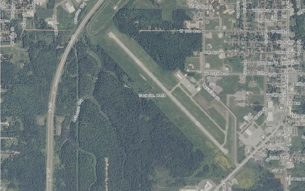
By Self-made by the uploader, converted to jpg from the bmp file. - MARPLOT program from the CAMEO suite, http://www.epa.gov/osweroe1/content/cameo/marplot.htm, Public Domain, https://commons.wikimedia.org/w/index.php?curid=26339980 |
Airport Sault Ste. Marie Municipal Airport (KANJ) |
|
| 6150 |
6033 |
bali |
2018-05-25 19:44:41 |
 |
By United States Geological Survey (USGS) - USGS via TopoQuesthttp://topoquest.com/map.php?lat=34.494944&lon=-82.709028&datum=nad83&zoom=4&map=sat1m, Public Domain, https://commons.wikimedia.org/w/index.php?curid=20317674 |
Airport Anderson Regional Airport (KAND) |
|
|
|
|
|
|
|
|
|
| # |
ID
|
Uploaded by
|
Uploaded on
|
Picture
|
Description
|
Related item(s)
|
|