Pictures
| # |
ID


|
Uploaded by
|
Uploaded on

|
Picture
|
Description
|
Related item(s)
|


|
| 6151 |
6032 |
 bali |
2018-05-25 19:44:29 |
 |
By United States Department of Agriculture (USDA), Farm Services Agency - National Agriculture Imagery Program (NAIP) Orthoimagery for Zone 16 Alabama State Quarter Quadrangle MUNFORD, NE and I.D. # n_3308525_ne_16_1_20060615.tif, Public Domain, htt |
Airport Anniston Regional Airport (KANB) |
|
| 6152 |
6031 |
bali |
2018-05-25 19:44:15 |
 |
By User: (WT-shared) Chelseyafoster at wts wikivoyage - Own work, Public Domain, https://commons.wikimedia.org/w/index.php?curid=23397329 |
Airport Gratiot Community Airport (KAMN) |
|
| 6153 |
6030 |
bali |
2018-05-25 19:44:06 |
 |
By USGS - United States Geological Survey digital orthophotoquad via TerraService WebMap Server, Public Domain, https://commons.wikimedia.org/w/index.php?curid=3588355 |
Airport Rick Husband Amarillo International Airport (KAMA) |
|
| 6154 |
6029 |
bali |
2018-05-25 19:43:56 |
 |
By United States Department of Agriculture (USDA), Farm Services Agency - National Agriculture Imagery Program (NAIP) Orthoimagery for Zone 16 Alabama State Quarter Quadrangle ALEXANDER CITY, SW and I.D. # n_3208501_sw_16_1_20060630.tif, Public Doma |
Airport Thomas C. Russell Field (KALX) |
|
| 6155 |
6028 |
bali |
2018-05-25 19:43:40 |
 |
By United States Geological Survey (USGS) - USGS via TopoQuesthttp://www.topoquest.com/map.php?lat=46.09472&lon=-118.28889&datum=nad83&zoom=4&map=sat1m&coord=d&mode=zoomin&size=l, Public Domain, https://commons.wikimedia.org/w/index.php?curid=195582 |
Airport Walla Walla Regional Airport (KALW) |
|
| 6156 |
6027 |
bali |
2018-05-25 19:43:27 |
 |
By Unknown - National Archives/United States Navy image via Ron Plante , Public Domain, https://commons.wikimedia.org/w/index.php?curid=24835078 |
Airport Naval Auxiliary Air Station Charlestown (KALF) |
|
| 6157 |
6026 |
bali |
2018-05-25 19:43:18 |
 |
By Troop330 at English Wikipedia, CC BY-SA 3.0, https://commons.wikimedia.org/w/index.php?curid=7984973 |
Airport Akron Fulton International Airport (KAKR) |
|
| 6158 |
6025 |
bali |
2018-05-25 19:43:09 |
 |
By Daniel Betts - https://www.flickr.com/photos/redlegsfan21/6284802252/, CC BY-SA 2.0, https://commons.wikimedia.org/w/index.php?curid=21960861 |
Airport Habersham County Airport (KAJR) |
|
| 6159 |
6024 |
bali |
2018-05-25 19:42:59 |
 |
By Wingtipvortex - Own work, CC BY-SA 3.0, https://en.wikipedia.org/w/index.php?curid=36802933 |
Airport Corona Municipal Airport (KAJO) |
|
| 6160 |
6023 |
bali |
2018-05-25 19:42:50 |
 |
By Zac Miller - http://www.zmproductions.com, CC BY-SA 3.0, https://en.wikipedia.org/w/index.php?curid=15523835 |
Airport Bader Field (KAIY) |
|
| 6161 |
6022 |
bali |
2018-05-25 19:42:42 |
 |
By United States Department of Agriculture (USDA), Farm Services Agency - National Agriculture Imagery Program (NAIP) Orthoimagery for Zone 16 Alabama State Quarter Quadrangle ALICEVILLE SOUTH, NE and I.D. # n_3308863_ne_16_1_20060621.tif, Public Do |
Airport George Downer Airport (KAIV) |
|
| 6162 |
6021 |
bali |
2018-05-25 19:42:28 |
 |
By United States Geological Survey (USGS) - USGS The National Map, via MSR Maps (formerly TerraServer-USA)http://msrmaps.com/map.aspx?t=1&s=12&lon=-81.685036&lat=33.649376&w=600&h=400, Public Domain, https://commons.wikimedia.org/w/index.php?curid=6 |
Airport Aiken Municipal Airport (KAIK) |
|
| 6163 |
6020 |
bali |
2018-05-25 19:42:15 |
 |
By United States Geological Survey (USGS) - USGS The National Map, via MSR Maps (formerly TerraServer-USA)http://msrmaps.com/map.aspx?t=1&s=12&lon=-89.110833&lat=45.154167&w=600&h=400, Public Domain, https://commons.wikimedia.org/w/index.php?curid=9 |
Airport Langlade County Airport (KAIG) |
|
| 6164 |
6019 |
bali |
2018-05-25 19:42:02 |
 |
By United States Geological Survey (USGS) - USGS via TopoQuesthttp://www.topoquest.com/map.php?lat=42.05202&lon=-102.80713&datum=nad83&zoom=8&map=sat1m&coord=d&mode=zoomout&size=l, Public Domain, https://commons.wikimedia.org/w/index.php?curid=19577 |
Airport Alliance Municipal Airport (KAIA) |
|
| 6165 |
6018 |
bali |
2018-05-25 19:41:49 |
 |
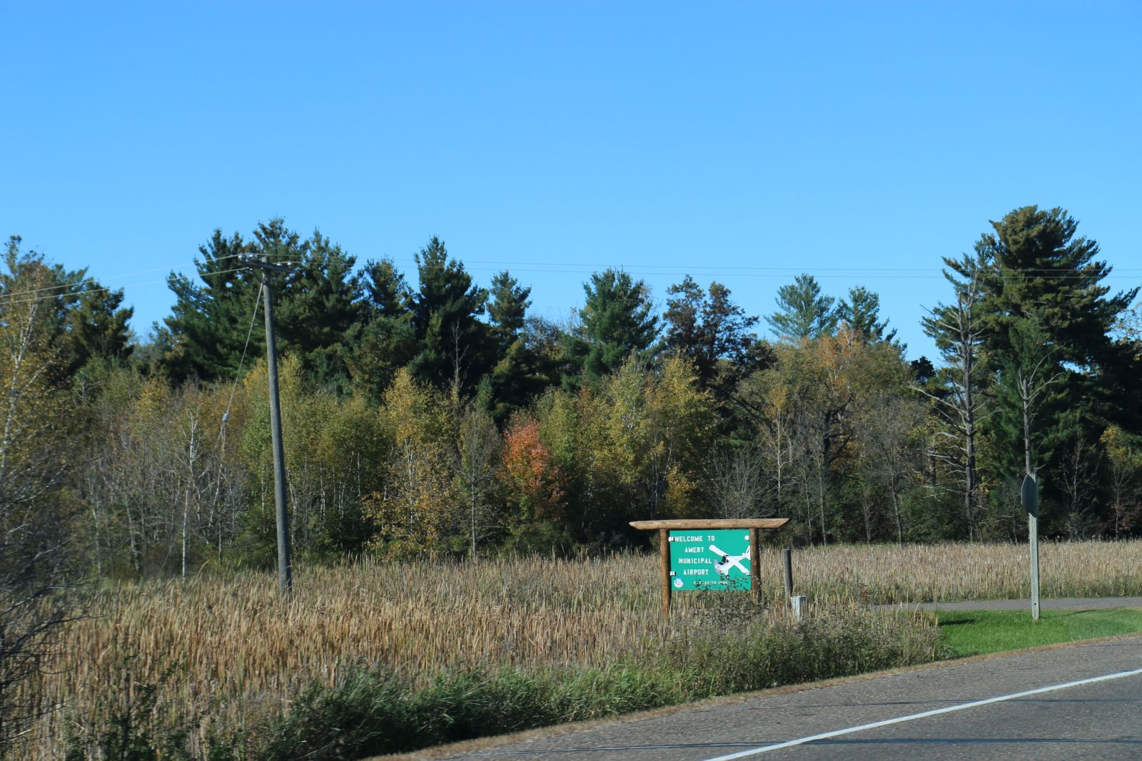
By Royalbroil - Own work, CC BY-SA 4.0, https://commons.wikimedia.org/w/index.php?curid=57451052 |
Airport Amery Municipal Airport (KAHH) |
|
| 6166 |
6017 |
bali |
2018-05-25 19:41:41 |
 |
By United States Geological Survey (USGS) - United States Geological Survey (USGS), Public Domain, https://commons.wikimedia.org/w/index.php?curid=19958751 |
Airport Amedee Army Airfield (KAHC) |
|
| 6167 |
6016 |
bali |
2018-05-25 19:41:30 |
 |
By US Geological Survey - http://www.topoquest.com/map.php?lat=33.37000&lon=-81.96444&datum=nad83&zoom=4&map=sat1m&coord=d&mode=zoomin&size=l, Public Domain, https://commons.wikimedia.org/w/index.php?curid=20290997 |
Airport Augusta Regional Airport (KAGS) |
|
| 6168 |
6015 |
bali |
2018-05-25 19:41:18 |
 |
By Civil Air Patrol - Arkansas Department of Aeronautics, Public Domain, https://commons.wikimedia.org/w/index.php?curid=50949073 |
Airport Magnolia Municipal Airport (KAGO) |
|
| 6169 |
6014 |
bali |
2018-05-25 19:41:09 |
 |
By Jonmkj - Own work, Public Domain, https://commons.wikimedia.org/w/index.php?curid=6637135 |
Airport Anson County Airport (KAFP) |
|
| 6170 |
6013 |
bali |
2018-05-25 19:41:01 |
 |
By Generic1139 - Own work, CC BY 3.0, https://commons.wikimedia.org/w/index.php?curid=37936569 |
Airport Washington County Airport (Pennsylvania) (KAFJ) |
|
| 6171 |
6012 |
bali |
2018-05-25 19:40:52 |
 |
By USAF - Active Air Force Bases Within the United States of America on 17 September 1982 USAF Reference Series, OFFICE OF AIR FORCE HISTORY UNITED STATES AIR FORCE WASHINGTON, D.C., 1989., Public Domain, https://commons.wikimedia.org/w/index.php?cu |
Airport Alexandria International Airport (Louisiana) (KAEX) |
|
| 6172 |
6011 |
bali |
2018-05-25 19:40:39 |
 |
By dsearls - , CC BY-SA 2.0, https://commons.wikimedia.org/w/index.php?curid=10190596 |
Airport Double Eagle II Airport (KAEG) |
|
| 6173 |
6010 |
bali |
2018-05-25 19:40:30 |
 |
By Civil Air Patrol - Arkansas Department of Aeronautics, Public Domain, https://commons.wikimedia.org/w/index.php?curid=25049720 |
Airport Dexter B. Florence Memorial Field (KADF) |
|
| 6174 |
6009 |
bali |
2018-05-25 19:40:21 |
 |
By US Geological Survey - http://www.topoquest.com/map.php?lat=32.110799&lon=-84.188848&datum=nad83&zoom=4&map=sat1m, Public Domain, https://commons.wikimedia.org/w/index.php?curid=20292741 |
Airport Jimmy Carter Regional Airport (KACJ) |
|
| 6175 |
6008 |
bali |
2018-05-25 19:40:10 |
 |
By US Geological Survey - http://www.topoquest.com/map.php?lat=31.535278&lon=-84.194444&datum=nad83&zoom=4&map=sat1m, Public Domain, https://commons.wikimedia.org/w/index.php?curid=20289868 |
Airport Southwest Georgia Regional Airport (KABY) |
|
|
|
|
|
|
|
|
|
| # |
ID
|
Uploaded by
|
Uploaded on
|
Picture
|
Description
|
Related item(s)
|
|